| Difficulty: | Number: | Miles: | Altitude: | Obstacles: | Time: |
|---|---|---|---|---|---|
| Easy 1 | FR 128, CR81 | 16.5 | 9,660 ft. | NA | 2-3 hours |
Sulphur Ranger District
Grand County
Granby, Colorado 80446
308 Byers Avenue
Hot Sulphur Springs, CO 80451
(970)725-3347
Closure:
July - Best
August - Best
September - Best
October - Early snows possible
Accessed:
Broken Thumb, FT 60 - Hike, Horseback, Mountain Bike, Motorcycle
Twisted Ankle, FT 70 - Hike, Horseback, Mountain Bike
Devil's Thumb Park, FT 7.1 - Hike, Horseback, Mountain Bike
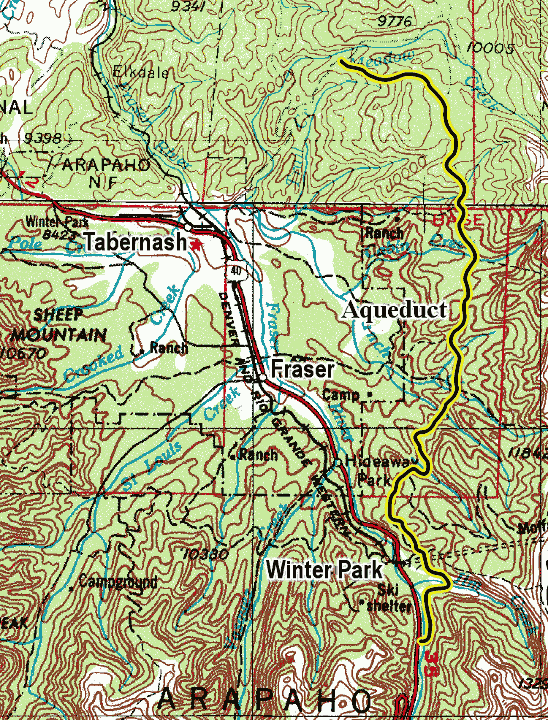
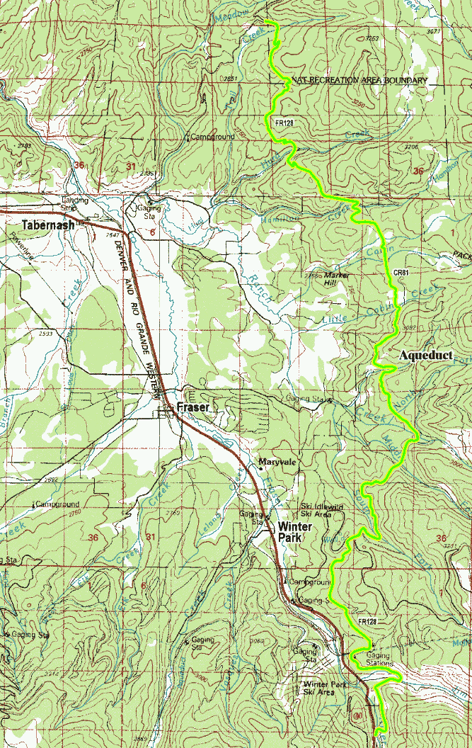
From Tabernash, CO. head east on US-40 E toward County Road 525 for 1.1 miles. Turn left onto Colorado Hwy 83 and do 0.4 miles. Turn left onto County Road 84/Forest Road 129 and continue to follow County Road 84 for 0.9 miles. Turn left onto Forest Road 129 and go 4.8 miles. Turn left onto Forest Road 128.
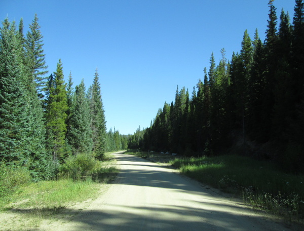 |
South end of road photo by: Adam M |
|---|
The main road will continue north along the ditch passing a few more camp sites. You will cross over the ditch and head east toward the Jim Creek trailhead. After passing the trailhead you will head back west passing a few more campsites before coming back along side the water ditch. From here the road works through the forest and you drive above a residential area opposite the Winter Park Ski Resort.
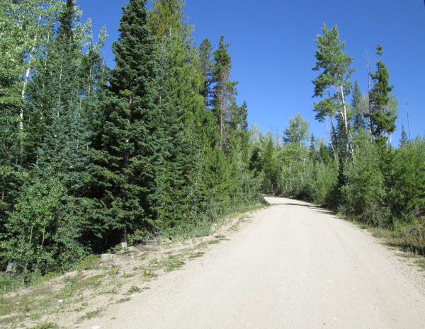 |
South end of road photo by: Adam M |
|---|
You will come to another intersection with a spur road to your right. This is FR128.1C which goes back along a short section of the ditch. Past this intersection you will be following the ditch again. When you come out of the trees into an open area you will be on County Road 81. The road widens out here and is used as a campsite, and the water diversion ditch will have gone underground. Next you will come to a large four way intersection. Stay straight ahead crossing County Road 80, part of the Rollins Pass railroad route.
This is as far as I have driven this road. From here the description is based on Google Earth.
The road will head into the forest and go around a hairpin turn, crossing back onto Forest Service land. (From this point on there will be sections of the road that cross Forest Service lands, and sections that are private with the county road crossing them.) The road will make another turn crossing South Fork Ranch Creek and passing a campsite along the road. You will head through the trees for a while. At a sweeping right turn in the road there will be a very wide spot. This is where the Broken Thumb and Twited Ankle trails connect with the road. As you continue you will pass another campsite and then come to an un-named spur road on the right that goes to some campsites. Continue north on FR128. Shortly you will be off of Forest Service lands and the road will pass spurs on the left and right, some being blocked. Stay with the main road. After a while you will pass another campsite on the left and make a sweeping curve to the west. The road will now pass above some private residents east of Fraser. Next you will cross Little Cabin Creek and be back on Forest Service lands. The road will head north passing a campsite and then the spur road FR128.2C on the right which goes to the Devil's Thumb Park trailhead. Continue north and you will make a switchback to the left and come into a large open meadow. After crossing the meadow you will head into some thinner areas of the forest. The road will drop down and cross Hamilton Creek and pass the intersection with CR841 on the right. You will climb up out of the valley crossing a ridge and dropping down to cross Hurd Creek and then passing the Hurd Creek road on your right. A short distance further and you will pass the left intersection with the Hurd Creek road. You will again climb up out of the valley and cross the ridge passing a campsite. Further along you will come to an intersection with FR128.2A on the right, followed by an intersection with FR128.2B on the right. From here you will cross another ridge and drop down the other side passing a campsite. The road will then end at Meadow Creek, FR129, going left and right here.