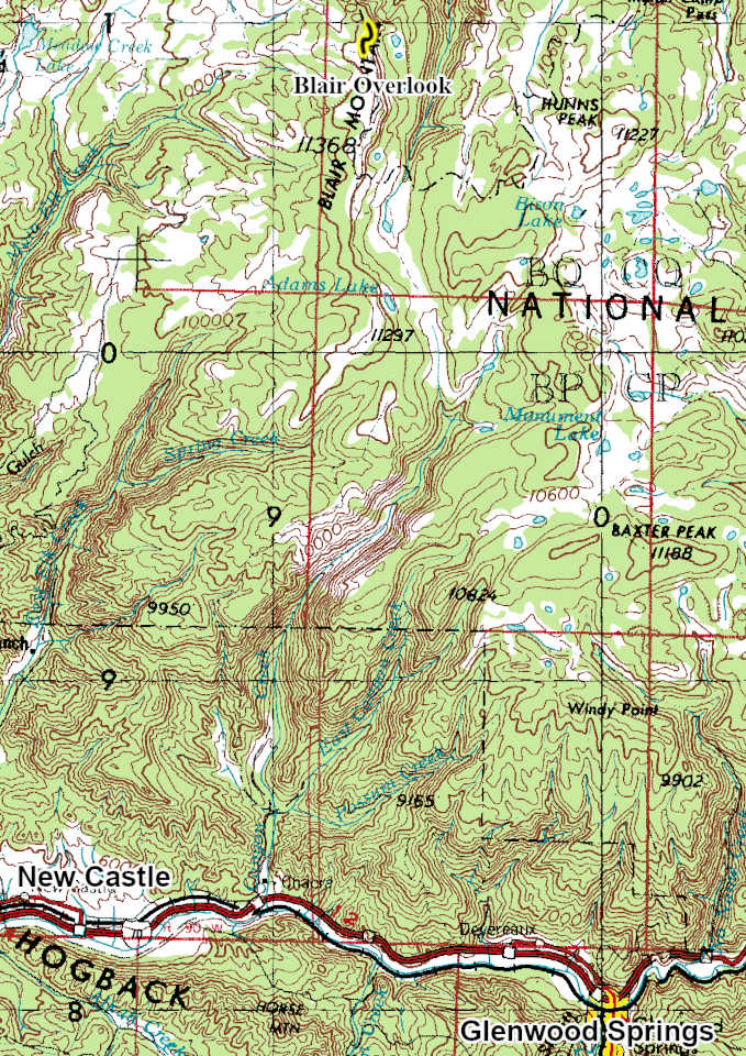
Blair Overlook
 |
| Maps/GPS: |


|
| USGS 7.5' Map: |
Blair Mountain |
| Statistics: |
| Difficulty: |
Number: |
Miles: |
Altitude: |
Obstacles: |
Time: |
| Easy 3 |
FR601.2E |
0.59 |
11,280 ft. |
NA |
1/2 hour |
|
| County: |
Garfield |
| Adopted by: |
|
|
|
| Managed by: |
White River National Forest, Rifle District |
0094 County Road 244, Rifle, CO 81650 |
(970)625-2371 |
| Summary: |
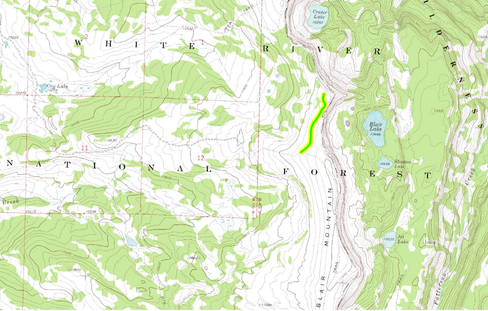
The Blair Mountain Overlook is a short spur road on the north side of Blair Mountain that gives you views of Crater Lake, Blair Lake, and Shadow Lake from the top of the sheer east slope of Blair Mountain. |
|
| Attractions: |
Scenery |
Seasonal
Closure: |
Agency - November 23 to May 22
|
| Best Time: |
June - Possible snow drifts
July - Best
August - Best
September - Best
October - Early snows possible |
Trail Heads
Accessed: |
|
| Camping: |
There are no dispersed campsites along the Blair Overlook 4WD road. |
| Base Camp: |
This would be a good area to base camp and explore all of the 4WD road networks in this area of the White River National Forest. |
| Fall Colors: |
Poor - There are no aspens in this area.
|
| Navigation: |
From New Castle, CO head toward Wheeler Lane and go 0.3 miles. North 7th Street turns slightly left and becomes Midland Ave go 0.4 miles. Continue onto County Road 245/Buford Road. Continue to follow County Road 245 for 3.1 miles. Turn right onto Main Elk Creek Road and go 18.2 miles. Turn right onto Forest Road 651 and go 8.4 miles. Continue onto Forest Road 601 and go 3.3 miles. Turn right onto the Blair Overlook road.
From Buford, CO on County Road 8 head toward New Castle Buford Road for 2.3 miles. Turn left onto County Road 10 and go 1.5 miles. Turn right onto New Castle Buford Road and go 14.3 miles. Turn left onto FR 601 and go 3.3 miles. Turn left onto FR 601 and go 4.1 miles. Turn right onto Forest Road 601 and go 5.6 miles. Turn left onto the Blair Overlook road.
|
| History: |
|
| Description: |
The Blair Overlook 4WD road is a short spur road off of Blair Mountain, FR601, 4WD road that goes to two overlooks on the north side of Blair Mountain. The road is an easy two track that crosses open areas and has one small hill to climb. Mostly the road is rocky with a section through a small group of pine trees. Starting from the Blair Mountain 4WD road you will head north across an open meadow toward the Flat Tops Wilderness. The gradual sloping west side of Blair Mountain will be out the drivers window. To the passenger side a short distance from the road is the sheer east side of Blair Mountain. The road will head to a small hill that you descend where you will come to a small group of stunted pine trees and a small parking area. This is the first over look of Blair Lake and Shadow Lake. There is a small jut of rock that gives you an great view point, just be carefull of the sheer drop from this vantage point.
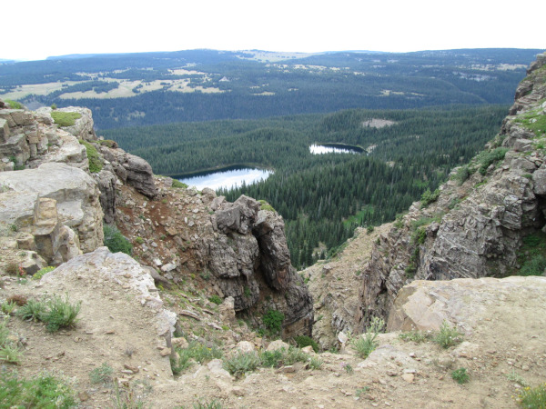 |
Looking east toward Blair Lake and Shadow Lake
photo by:
Adam M |
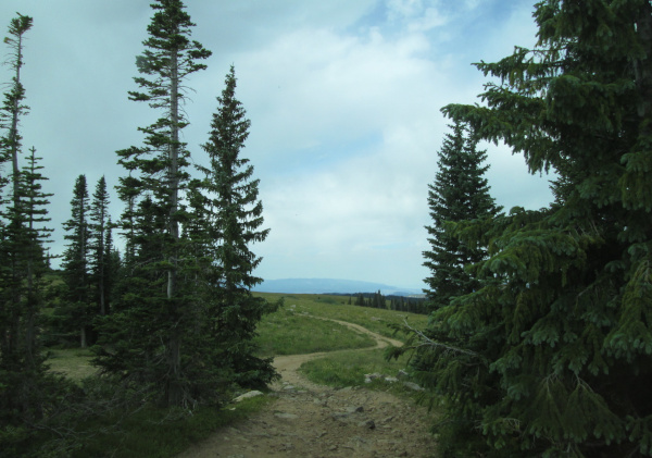
Continuing on the Blair Overlook road you will climb a small rocky hill and work your way through some small clusters of pine trees.
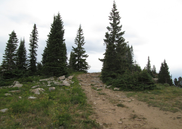 |
Small hill climb past first overlook
photo by:
Adam M |
The road will level out and continue to head north through the scattered pine trees.
 |
Center section
photo by:
Adam M |
There will be one rocky section of road just before you come to the second overlook parking area. From here you will have views of Crater Lake to the north with the Flat Top Wilderness in the distance.
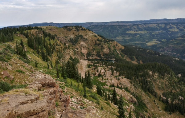 |
Looking north toward Crater Lake (center of picture)
photo by:
Adam M |
From here head back to the Blair Mountain road.
|
|
Data updated - May 30, 2026
4WD Road driven - July 29, 2025
Copyright 4X4Explore.com - 2000-2026 |