
| Difficulty: | Number: | Miles: | Altitude: | Obstacles: | Time: |
|---|---|---|---|---|---|
| Moderate 5 | FR505.1, Cnty116J, Cnty128J |
14.00 | 8,641 to 10,200 ft. | Mud - 3 Water - 1 |
2-3 hours |
Boulder Ranger District
Closure:
July - Good, snow may not be melted out in a wetter winter.
August - Best
September - Best
October - May get early snow.
Activities:
Hiking -
Equestrian -
Mountain Bike -
ATV -
Motorcycle -
Activities:
Snowshoeing -
Cross Country Skiing-
Snowmobile -
To start at the south end of Caribou, from Boulder, CO. on Canyon Blvd toward 26th Street for 2.0 miles. Continue onto CO-119/Boulder Canyon Drive for 15.1 miles. At the traffic circle, take the 3rd exit onto N Bridge Street and to 0.3 miles. Continue to follow CO-119 for 0.4 miles. Turn right onto Eldora Rd and go 1.4 miles. Keep right to continue on Eldora Rd/Eldorado Rd. Continue to follow Eldora Rd for 1.7 miles. Slight right onto Huron Ave and go 0.1 miles. Take the 2nd right onto 5th Street and go 180 feet. Turn right onto Washington Ave and go 151 feet. Take the 1st left onto the Caribou 4WD road, FR505.1.
When they returned they filed their claims in their names and their partners names. The two mines were developed for the rest of the year and into 1870. The first ore from the mines was shipped to New Jersey and brought $400 a ton. With this success a primitive road was made up Coon Creek called the Coon Trail which follows a natural drainage from Caribou to Cardinal to Dayton. Ore shipments now went down to Dayton and then to Black Hawk to the Boston & Colorado Smelter. Once the news of the strike got out there was a stampede and hundreds of claims were filed by the end of 1870. Caribou sprang up in the high meadow and a town plat was filed in September of 1870. By now over 400 people lived at Caribou and by 1872 there were over a hundred houses, the three story Sherman House Hotel, and an array of businesses. There was a bakery, brewery, meat market, grocery stores, a billards parlor, several saloons, and three hotels. The cemetary was placed north of town, a Methodists Church was built, as well as a school.
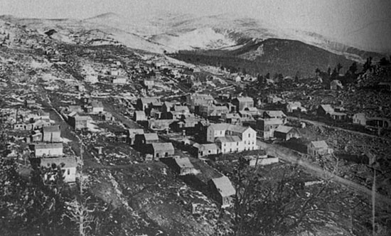 |
Caribou, 1873 photo: William H Jackson (Colorado Historical Society) |
|---|
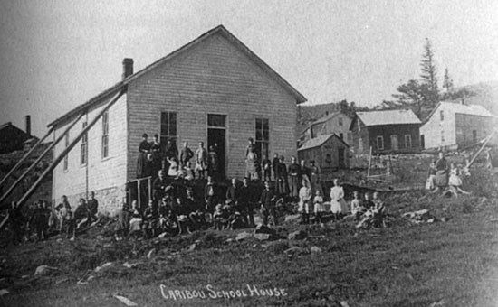 |
Caribou School House. Poles brace against the high winds photo: Denver Public Library, Western History Dept. |
|---|
The Caribou lode was sold to Abel Breed of Cincinnati, Ohio, with Martin retained as its superintendent. In 1871 a mill was constructed in Dayton saving the transportation costs to Black Hawk. In 1873 the Caribou was sold to the Mining Company of Nederland, Holland, which poorly managed the mine allowing it to bought at a sheriff's sale by Jerome Chaffee in 1876. By 1879 the Caribou had its biggest year with shipments over $1 million in silver.
Two stagecoach routes served the town, one from Boulder and the other from Central City. With the orientation of North and South Arapaho Peaks the winds were fierce and winter snows made for some harsh blizzards. A rope was tied to a point in the center of town and the other end secured at the Caribou Mine so that the miners could get home during the winter blizzards. Braces were used on the school house to protect it from the winds. Because of the hard winters school started on the frist of May and ran through the first of November.
 |
Caribou, 1920, Potosi Mine Boarding House photo: Denver Public Library, Western History Dept. |
|---|
With the silver crash of 1893 Caribou continued on, but it slowly became abandoded. The Post Office which opened in 1871 finally closed in 1917.
 |
Caribou's Sherman House Hotel, after the town was abandonded photo: Colorado Historical Society |
|---|
Jessen, Kenneth Ghost Towns Colorado Style, Volumn 1, 1st ed. Loveland, Colorado: J.V. Publications, 1998. Print.
This description starts the Caribou 4WD road off of County Road 116J just before reaching Rainbow Lakes Campground on the edge of the Indian Peaks Wilderness. The road will drop down to a valley with old beaver dams and a wide marshy area. This was once going to be a reservoir. The road will head east and follow the edge of the valley to a crossing of Caribou Creek. This is the site of the Windy Gap Dam, which was never built. After crossing the creek you will drive through a few mud holes, if your early in the season, some will be dry if your later in the season, and follow along the other side of the meadow. Stay on the road. Don't drive in the marsh area or into the creek.
 |
Caribou 4WD road along meadow, 2014 photo by: Adam M |
|---|
 |
Caribou 4WD road mud hole, 2014 photo by: Adam M |
|---|
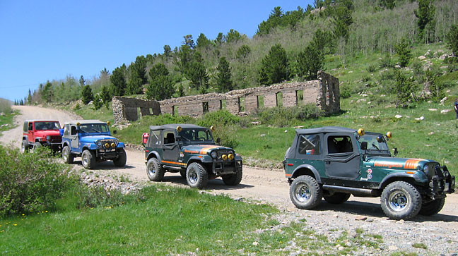
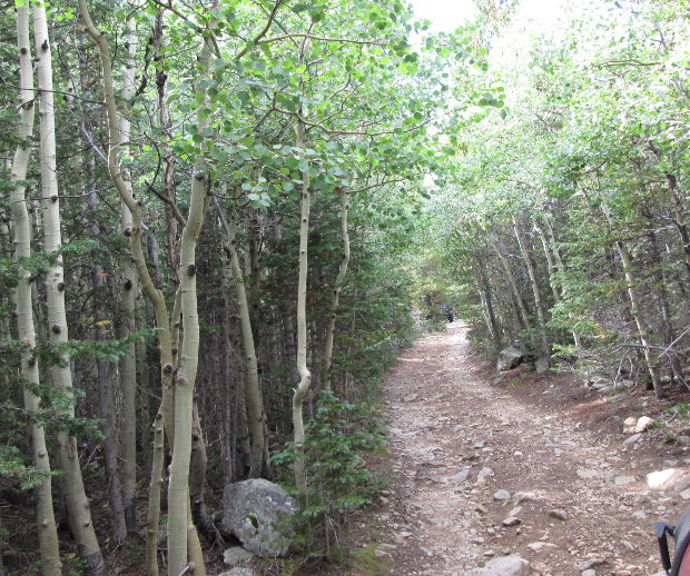
As you enter the forest the road will become a bit narrower. You will have to navigate a narrow section near a large boulder and cross a few rocky bottomed mud holes. You will come out of the forest to a more open area and continue to follow the creek. You will come to an intersection to the right with FR116J.1 and 505.2A that go a half mile to some mine tailings. Stay to the left to continue on the Caribou 4WD road. The road will climb up away from the creek and pass the wide peat bog area on the west side of the road (look for the crane). Just past the peat bog you will come to the seasonal gate and parking lot at the Caribou town site.
 |
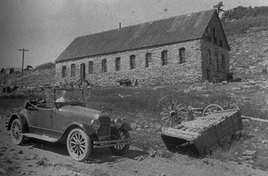
Potosi Mine boarding house, 2014 photo by: Adam M |
|---|
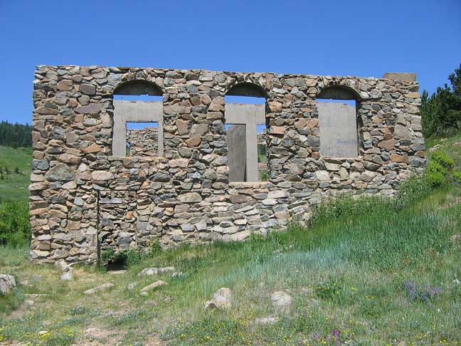 |
Potosi Mine boarding house, 2014 photo by: Adam M |
|---|
The Caribou 4WD road continues from here by going up hill to the west out of the parking area. I have driven this section to Eldora many years ago, but have not recently so I don't want to venture a description as Travel Planning has changed this section over the years.
In September, 2019 I drove the south side to the connection with the spur 128J.3. Along the road below the Comstock mine building on Caribou Hill is one of the mine complex adits.
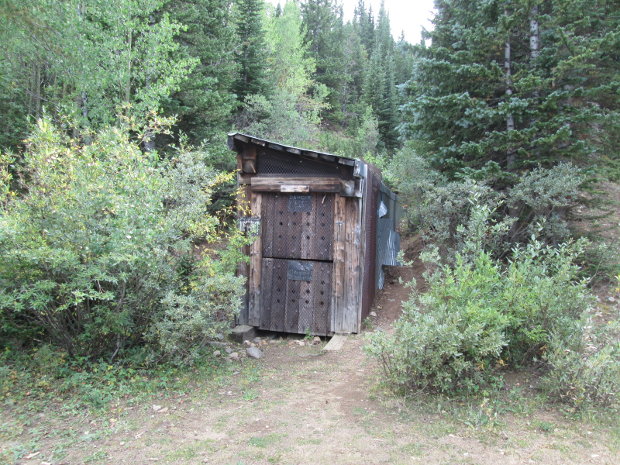 |
Mine adit, 2019 photo by: Adam M |
|---|
I followed the spur 128J.3 to its end point where a trail continues into the wilderness.
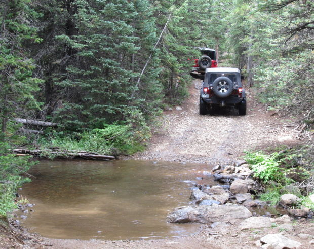 |
128J.3 creek crossing, 2019 photo by: Adam M |
|---|
 |
128J.3 spur road, 2019 photo by: Adam M |
|---|