

| Difficulty: | Number: | Miles: | Altitude: | Obstacles: | Time: |
|---|---|---|---|---|---|
| Difficult 8 | BLM6043, BLM6044 | 4.65 | 7,800 to 8,840 ft. | Rocks-5 | 4-5 hours |
Royal Gorge District
Canon City, CO 81212
Closure
July - Best
August - Best
September - Best
October - Early snows may close road
Accessed:
"Here a long time ago, when I was old enough to ride a horse, we drove cattle up Chinaman Gulch. My father showed me under that tree 'there be the Chinaman's cabin,'" said 87-year-old rancher Joe Cogan. "There were a low cabin, logs, and roof and a pile of rocks [and] apparently a fireplace. I said, 'Where's the Chinaman?' And dad said, 'He's long gone, but he cut ties in here to sell to the railroad.' The Chinaman was a tie-hack - that's what we called 'em. He was gone by 1889 - by the time we [Cogan's] arrived. It's part of the history of Chaffee County."
As of late 2021 Chinaman Gulch is still being considered for a name change.
Sidebar
CHAFFEE COUNTY, Colo. - What started as a nightmarish discovery unfolded into a piece of history that will come to peaceful close next week.
On March 29, 2016, Chaffee County Sheriff's Office deputies responded to a report of discovered human remains near Chinaman Gulch in Colorado, about a half mile east of County Road 301, the sheriff's office said. The deputies met with two men who said they were walking in the area and climbed a steep incline leading up to a large rock outcropping when they saw it: human remains in a deep ravine.
The next several days were full of investigation and excavation. The Chaffee County Crime Scene Team, Chaffee County Coroner's Office and detectives worked around the clock to recover a nearly complete set of human remains, plus several artifacts nearby. Authorities started investigating the case as a homicide, the sheriff's office said. The remains were turned over to the coroner's office and a forensic anthropologist examined them.
Several months later, the sheriff's office and coroner's office received reports from the anthropologist. The findings? The remains belonged to a 15- to 18-year-old male and dated back to the mid- to late-1800s. He was a pioneer. He had damage to his cranium, which suggested that he had died as a result of blunt force injuries. Examiners and authorities do not know if that was caused by the fall, or if something had struck the teen. Because the remains were dated back so far, any witness or suspect to a potential crime in this case would already have almost certainly died, the sheriff's office said.
Chief Deputy Coroner Jeff Graf, Coroner Randy Amettis and Sheriff John Spezze plan to hold an organized funeral and burial - including a donated personalized gravestone and ceremony - to lay the pioneer to rest. "Because of the age of the remains and the almost certain likelihood that no witness to a criminal case is still alive we collaboratively decided to go this direction to finally lay this unknown teenage boy to rest," the sheriff's office said. The service is scheduled for 10 a.m. June 27 at Fairview Cemetery, located at 8105 Co Road 144, Salida.
Arkansas Valley Voice Chinaman Gulch, Web
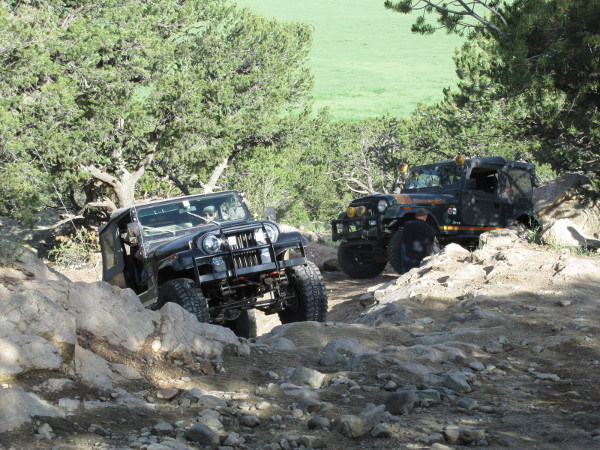 |
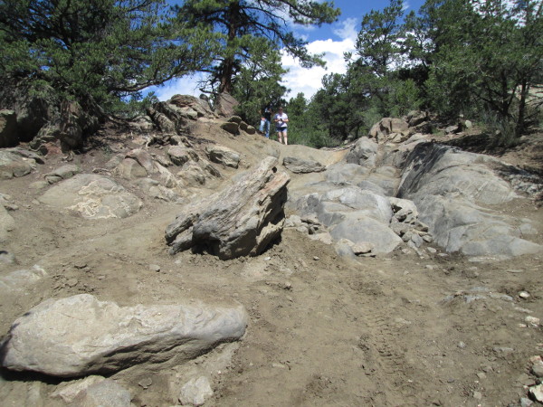
First Rock Garden obstacle. photo by: Adam M |
|---|
The road will continue to climb with some rocks and ledges to navigate before leveling out a bit. You will start into another climb where the small gulch on your left narrows up. This is where you will come to the second Rock Garden obstacle which is a sharp ridge fin with a knob in the center. The obstacle is narrowed by the larger rocks on the side.
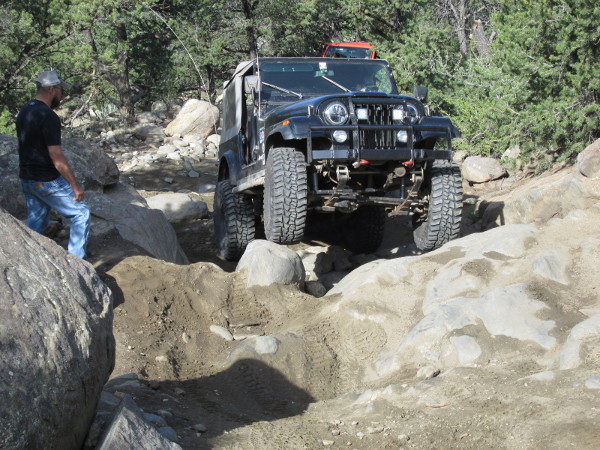 |
Second Rock Garden obstacle. photo by: Adam M |
|---|
 |
Second Rock Garden obstacle. photo by: Adam M |
|---|
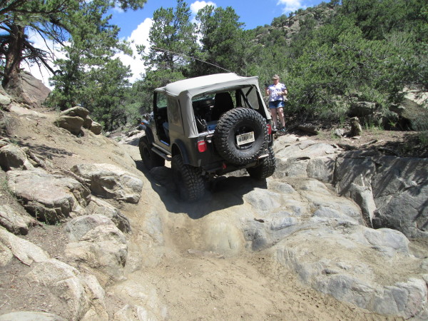
Past this obstacle the road will continue to climb up to a wide intersection. The road on the right is the exit from Carnage Canyon. Stay left here, where BLM 6044 begins, and head down hill to go to Chinaman Gulch. The road will go down, crossing some rocky sections and then climb up over a soft ridge. The trees will thin a bit as you head down to a dry wash, cross it and head up a short hill. At the top of the hill will be a spur road to the left that goes to an overlook of the Arkansas River valley. Continue down the hill. Shortly you will come to Chinaman Gulch. The road in front of you that climbs up is the exit from the Chinaman loop. You will end up back here later. Turn right and head up Chinaman Gulch. After a bit you will pass a large set of boulders along the side of the wash called the Rock Pile, which some people drive over. Continue to head up the wide wash. The wash will head into the trees and then narrow up a bit bringing you to the Whales Tail obstacle.
 |
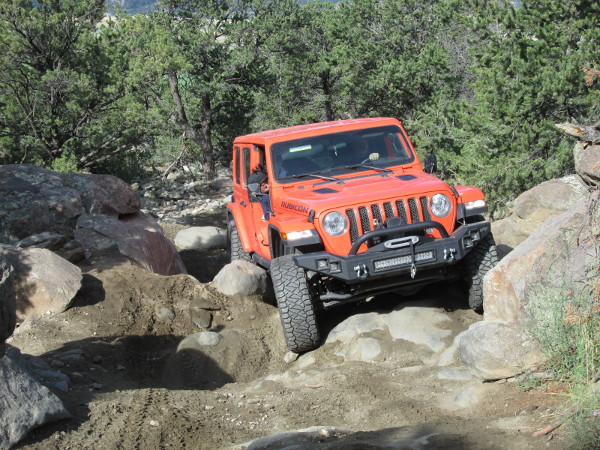
Gage K on Whales Tail obstacle. photo by: Adam M |
|---|
Past the Whales Tail the wash will stay narrow as you head up over smaller obstacles and in between the trees. As you climb higher you will come out into a flatter area and weave through the pinion pines. The road will head north and come to another obstacle called the Stairs. This obstacle has a bypass to the left. Beyond the Stairs there will be a few more small obstacles before you come to the Chute.
 |
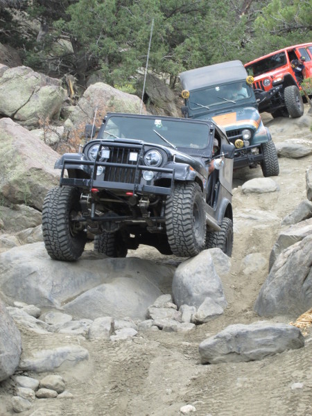
Chutes obstacle. photo by: Adam M |
|---|
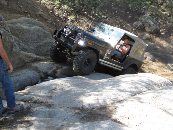
The Chute is a slot in a rock outcrop that has a few large boulders to navigate as you make the climb.
 |
Gage K on the Chutes obstacle. photo by: Adam M |
|---|
Past the Chute the road will head to the west climbing slightly. The road will then head south and begin to drop down hill and become a bit challenging again.
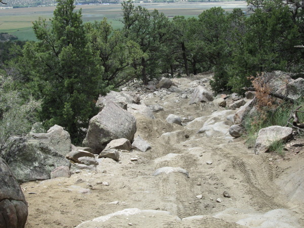 |
Heading down back to the loop intersection. photo by: Adam M |
|---|
You will then come out into an open area with a wide curve and a view of the mountains to the west. From here the road will head down to the intersection at Chinaman Gulch. Cross the gulch and head back up the way you came in, then down through the Rock Garden back to the trailhead parking area.
 |
Heading down through the Rock Garden photo by: Adam M |
|---|