Cliff Lakes
 |
| Maps/GPS: |


|
| USGS 7.5' Map: |
Meadow Creek Lake |
| Statistics: |
| Difficulty: |
Number: |
Miles: |
Altitude: |
Obstacles: |
Time: |
| Easy 3 |
FR601.4E |
0.88 |
9,880 ft. |
NA |
1/2 hour |
|
| County: |
Rio Blanco |
| Adopted by: |
|
|
|
| Managed by: |
White River National Forest, Rifle District |
0094 County Road 244, Rifle, CO 81650 |
(970)625-2371 |
| Summary: |
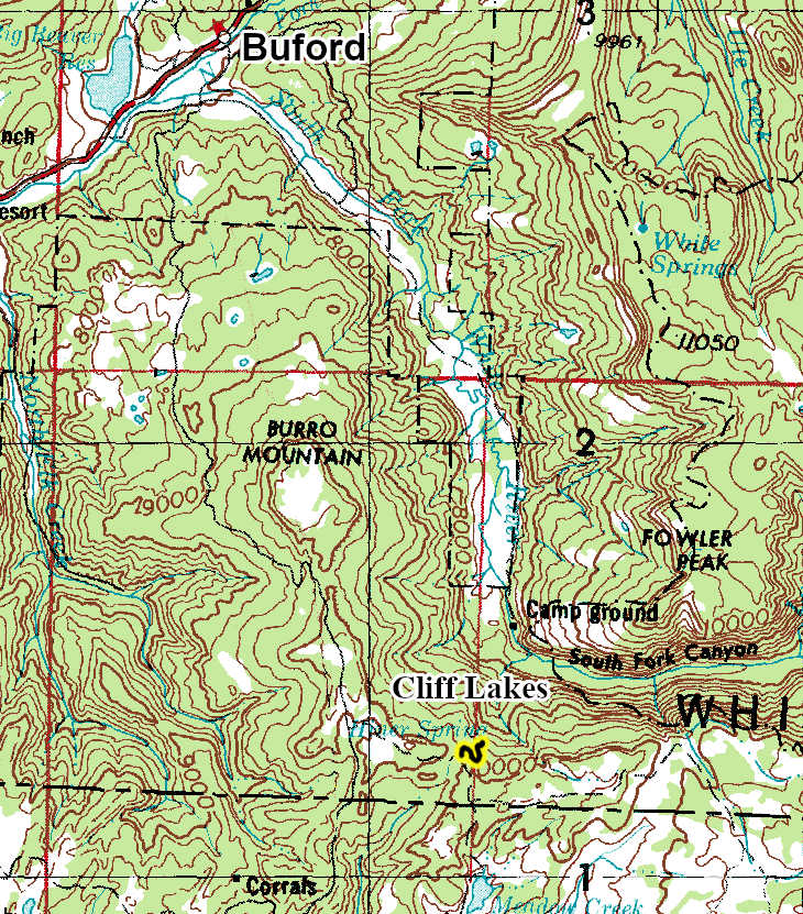
The Cliff Lakes 4WD road is a spur road off of Blair Mountain, FR601, that drops down the side of the canyon of the South Fork of the White River to a couple of small lakes. |
|
| Attractions: |
Scenery, Trail Heads |
Seasonal
Closure: |
Agency - November 23 to May 22
|
| Best Time: |
June - Possible snow drifts
July - Best
August - Best
September - Best
October - Early snows possible |
Trail Heads
Accessed: |
Cliff Lakes Trailhead
Cliff Lake Trail FT1831 - Hike, Pack and Saddle.
|
| Camping: |
There are no dispersed campsites along the Cliff Lakes 4WD road, though you could camp near the main lake. |
| Base Camp: |
This would be a good area to base camp and explore all of the 4WD road networks in this area of the White River National Forest. |
| Fall Colors: |
Average - There are aspens in the canyon below Cliff Lakes.
|
| Navigation: |
From New Castle, CO head toward Wheeler Lane and go 0.3 miles. North 7th Street turns slightly left and becomes Midland Ave go 0.4 miles. Continue onto County Road 245/Buford Road. Continue to follow County Road 245 for 4.2 miles. Turn right onto New Castle Buford Road and go 21.4 miles. Turn right onto FR 601 and go 2.5 miles. Turn left onto Forest Road 601.4E.
From Buford, CO on County Road 8 head toward New Castle Buford Road for 2.3 miles. Turn left onto County Road 10 and go 1.5 miles. Turn right onto New Castle Buford Road and go 14.3 miles. Turn left onto FR 601 and go 2.5 miles. Turn left onto Forest Road 601.4E.
|
| History: |
|
| Description: |
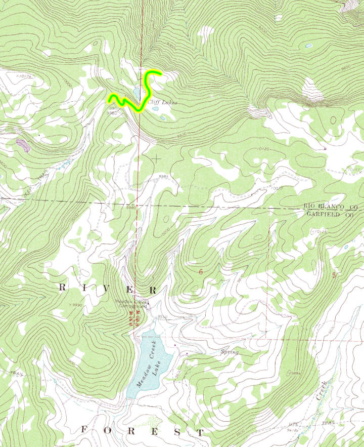
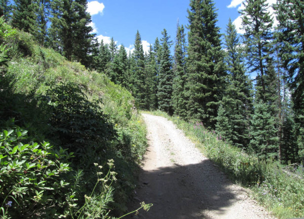
The Cliff Lakes 4WD road is a bit tricky to find. The visible spur road off of Blair Mountain, FR601, 4WD road is to the Cliff Lakes Trailhead parking area. It sits in the forest a short distance from FR601. To the east of the trailhead spur is a small road going into the forest that is less visible, which is the Cliff Lakes 4WD Road. It will head into the forest behind the Cliff Lakes Trailhead and make a ninety degree turn to drop down over the edge of the canyon of the South Fork of the White River. The road is a two track and as it drops down it is a bit of a narrow shelf road before entering a little narrow valley in the forest.
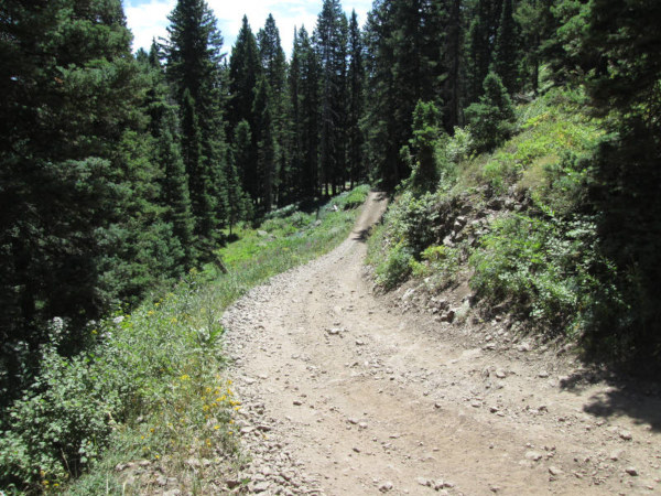 |
Heading down from FR601
photo by:
Adam M |
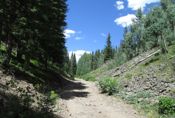
After coming down a switchback you will come to a more level area with small open meadows. There is a short spur road on the right to a small pond that is one of the lakes. Staying left you will come to another spur to the left that goes over a small hill and drops you down to the main Cliff Lake.
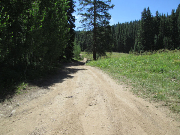 |
Road down to the main lake
photo by:
Adam M |
There are a few parking spots along the shore of the lake.
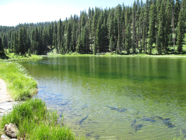 |
Main Cliff Lake
photo by:
Adam M |
If you continue right instead of going to the main lake you will head into the forest for a short distance before coming out into an open area where the road ends at another small bench with a view out over the canyon of the South Fork of the White River. You will go back the way you came climbing up the little valley and the turn at the start.
 |
Heading back
photo by:
Adam M |
 |
Final climb back up
photo by:
Adam M |
|
|
Data updated - May 5, 2026
4WD Road driven - July 28, 2025
Copyright 4X4Explore.com - 2000-2026 |