| Difficulty: | Number: | Miles: | Altitude: | Obstacles: | Time: |
|---|---|---|---|---|---|
| Graded | FR600 | 37.87 | 10,605 ft. | NA | 2 hours |
Closure:
July - Best
August - Best
September - Best
October - Early snows possible
Accessed:
Johnson Pasture FT1852 - Hike, Pack and Saddle
Sweetwater FT1854 - Hike, Pack and Saddle
Trappers Lake FT1816 - Hike, Pack and Saddle
Fawn Creek FT1838 - Hike, Pack and Saddle
South Fork FT1827 - Hike, Pack and Saddle
South Fork Bridge FT1827.1 - Hike, Pack and Saddle
Wagon Wheel FT2049 - Hike, Pack and Saddle
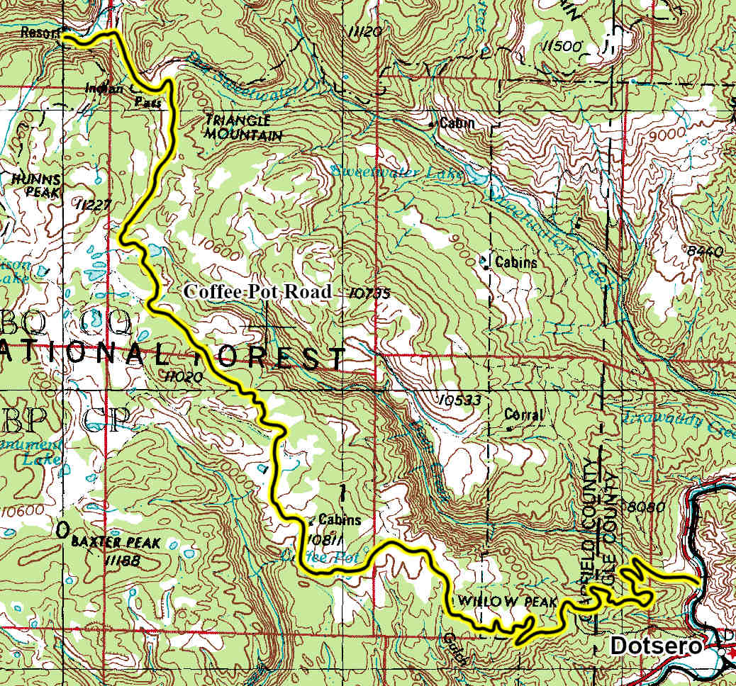
From Glenwood Springs, CO head west on 6th Street for 276 feet. At the traffic circle, take the 3rd exit and continue straight onto CO-82 W. Turn left to merge onto I-70 E and go 0.1 miles. Merge onto I-70 E and go 17.3 miles. Take exit 133 toward US-6 E and go 0.3 miles. Turn left onto US-6 E and go 443 feet. At the traffic circle, take the 2nd exit onto 301/Colorado River Rd and go 1.8 miles. Turn left onto Coffee Pot Rd/Deep Creek Rd.
The Coffee Pot Road will cross a large open area heading toward a forested area. Just before heading into the trees you will pass FR600.3L on the left which is a short spur road with a dispersed campsite. The main road will head into the forest and work its way around Willow Peak to the north. Once you come back out into a large open area you will pass another dispersed campsite on the right. From here the road will cross the large meadow as it heads toward the Deep Creek Overlook, FR600.3A, which is a great side trip. After passing Deep Creek Overlook you will continue across the large open meadow coming to FR604 on the left. This is another short spur road. Continuing on the main road you will head to a large aspen forest where you will pass the Coffee Pot Springs Campground on the left. Further through the aspens you will come to a small opening with a dispersed campsite before heading back into the aspens. Again you will come out of the aspens and cross a large open meadow before driving through a small group of aspens and then heading back out into another large open meadow.
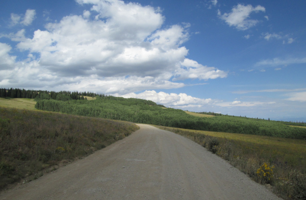 |
Typical section of the Coffee Pot Road photo by: Adam M |
|---|
The Coffee Pot Road will then turn and head north running parallel with Broken Rib Creek off to the west. The road will head for a pine forest and cross through a small section of the trees passing another dispersed campsite. Past the pine trees you will cross another open area known as Crane Park and then cross the upper section of Broken Rib Creek. From here you will head west again crossing a very large open meadow, then turning north and crossing a side tributary of Grizzly Creek before heading toward some pine trees again. The road will skirt the edge of the forest and head east then west through open meadows passing pine forests. You will pass FR632 on the left as the landscape changes to be more rocky. Past FR632 you will come to spur road FR600.3B on the left known as the Boom Boom Pit. It goes a short distance to a small gravel pit. Continuing on the main road you will do a couple wide sweeping curves through the pines before coming out into another large open area where you will pass FR633 on the right which is a short spur road that goes to FT1852. Continuing northwest you will pass through pines and small open areas for a while where there are three dispersed campsites then passing FR614 on the left which goes to White Owl Lake. Continuing on you will pass another dispersed campsite before coming to a large Y intersection. The road on the left is Blair Mountain, FR601, 4WD road while the Coffee Pot Road continues to the right. Heading north you will pass another dispersed campsite before coming to the Deep Lake Campground entrance on the right. Just past the entrance you will come to the Deep Lake Day Use area on the right.
Past the Deep Lake area you will cross Deep Creek and then head northeast passing another short spur road that goes down to Deep Lake. Past the lake you will come to FR618 on the right, stay to the left to continue on the Coffee Pot Road. The road will turn to the northwest passing a few more dispersed campsites before heading into the pines again. As the road comes out of the forest again you will pass a dispersed campsite on the left then cross Buck Creek and come to FR630 also on the left. Staying right the road will head northeast again up the shallow valley following Buck Creek. The road will make a sweeping curve passing another dispersed campsite and then crossing Buck Creek again. The road will continue to follow Buck creek as it heads north coming to the Indian Camp Pass parking area and trailhead. Hiking trails FT1816 and FT1854 head out from here. The road will head west again and cross through the cut in the ridge created by Buck Creek, the actual pass, and continue to follow Buck Creek on the left with the Flat Tops Wilderness on the right. Where the valley widens out you will come to the Fawn Creek Parking Area and trailhead. Hiking trails FT1827 and FT1838 head out from here. The road will turn southwest following the South Fork of the White River and crossing Buck Creek again just above where it enters the South Fork of the White River. Just past this crossing are a hand full of dispersed campsites. The road continues west through some pines before coming to the South Bridge Parking Area and trailhead. Hiking trail FT1827 heads out from here crossing a bridge over the South Fork of the White River. Past the parking area the road will go a short distance to the Budges Wilderness Lodge where it ends.