

| Difficulty: | Number: | Miles: | Altitude: | Obstacles: | Time: |
|---|---|---|---|---|---|
| Easy 3 | FR 214 BLM 29620 None |
Forest Service 2.25 BLM 1.12 Wildlife Area 0.90 |
9.370 ft. | NA | 1-2 hours |
Northwest District BLM, Kremmling Field Office
2103 E. Park Ave., Kremmling, CO 80459
970-724-3000
Closure:
July - Best
August - Best
September - Best
October - Early snows possible
Accessed:
From Kremmling CO. head east on Park Ave toward 6th Street for 33 feet. Turn right at the 1st cross street onto CO-9 S/6th Street and continue to follow CO-9 S for 2.3 miles. Turn right onto County Hwy 1 and go 499 feet. Continue onto County Road 1/Trough Road for 13.0 miles. Continue onto New Trough Road for 1.0 mile. Continue onto Trough Road for 0.4 miles. Turn right onto County Hwy 11 and go 6.3 miles. Turn left to stay on County Hwy 11 and go 1.8 miles. Turn right onto FR214, the Hunter Road.
From Kremmling, CO. head west on US-40 W/Park Ave toward 5th Street and continue to follow US-40 W for 6.2 miles. Turn left onto CO-134 W and go 13.4 miles. Turn left onto Rd 206 and go 387 feet. Slight left onto FR212 and go 3.5 miles. Slight left to stay on FR212 and go 0.3 miles. Slight right to stay on FR212 and go 3.8 miles. Turn left onto FR214, the Hunter Road.
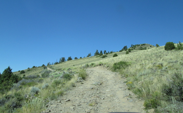 |
Start of road climbing Azure photo by: Adam M |
|---|
After climbing around the northwest side of Azure the two track road will head into some pines. The road will then head down into a low saddle passing a campsite on the left side of the road.
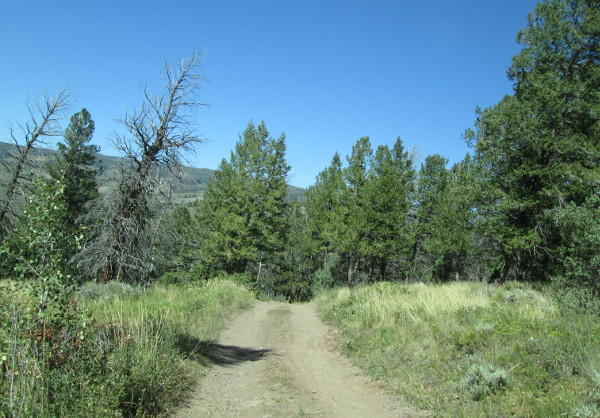 |
West end of the road photo by: Adam M |
|---|
After crossing the saddle the road will climb up onto a bare ridge heading northeast.
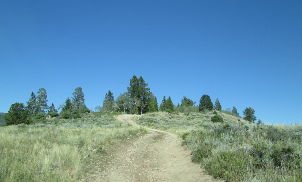 |
Climbing along the ridge photo by: Adam M |
|---|
Once on top the road will continue northeast along the ridge with views down to the Colorado River Gorge. As you come into an aspen grove you will pass a campsite on the right with a short road to a view spot above the Colorado River. Continuing along the two track you will pass another campsite on the left in the aspens. The road will come out into an open area and then head back into another small aspen grove. Here you will pass through a fence line where you will leave Forest Service lands and enter the Radium State Wildlive lands. The Forest Service section is 2.25 miles long.
The road will continue through a mix of pines and aspens where you will pass a short spur road on the right that goes to a campsite. The road will continue along a flat ridge between French Creek and Canyon Creek. Continue through the aspen and you will pass a road on the right that is blocked. Continue left through aspens and after a bit you will pass a campsite on the right. Continue along the main road and you will pass another campsite on the left. Past this campsite you pass through another fenceline where you leave the Radium State Wildlife area and enter onto BLM lands. The Wildlife section is 0.9 miles long.
You will now be on BLM29620 as you continue through the pines and come to an open area, then head back into the forest. After a bit you will come to an intersection with BLM29621 on your left. This road will head back southeast through aspens to the fenceline and the Wildlife lands. This length is 0.31 miles long. On Google Earth BLM29621 continues down the top of a small ridge in the Wildlife Area before ending above Canyon Creek. Back at BLM29620 you will continue north through a mix of pines and aspen until you come to a small meadow. The road is faint across the meadow, and has not seen much, if any traffic. Based on BLM data BLM29620 contiues north to another larger meadow and then loops to the east and back west to connect with itself. From the Google Earth images, large sections of this road have dead fall trees crossing it and it does not look like it is seeing use. The length of BLM29620 to the small meadow is 0.81 miles. The official length of BLM29620 is 3.51 miles. From the first small meadow you will return the way you came.