Little Froze
 |
| Maps: |


|
| USGS 7.5' Map: |
Deer Peak |
| Statistics: |
| Difficulty: |
Number: |
Miles: |
Altitude: |
Obstacles: |
Time: |
| Easy 1 |
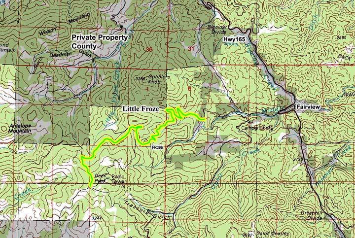
FR396 |
5.81 |
9,560 to 10,800 ft. |
NA |
1 hour |
|
| County: |
Custer |
| Adopted by: |
|
|
|
| Managed by: |
Pike and San Isabel National Forest,
San Carlos Ranger District |
3028 East Main Street
Canon City, CO 81212 |
(719)269-8500 |
| Summary: |
Little Froze climbs Elmer Canyon on the north side of Deer Peak, crosses a ridge and goes to the head of Little Froze creek. |
| Attractions: |
None
|
Seasonal
Closure: |
Agency - December 2 to April 30 |
| Best Time: |
June - May still be snowed in
July - Best
August - Best
September - Best
October - Watch for early snows |
Trail Heads
Accessed: |
|
| Camping: |
There are dispersed campsites past the private property. |
| Base Camp: |
This would be a good area to base camp. |
| Fall Colors: |
Very Good - Lots of aspen groves. |
| Navigation: |
From Rye, CO head north on Boulder Ave toward Roley Street for 0.1 miles. Turn left onto CO-165 W and go 16.5 miles. Turn left onto Ophir Creek Rd and go 1.1 miles. Slight left to stay on Ophir Creek Rd and go 482 feet. Continue straight onto County Rd 364 and go 2.2 miles. At the intersection past the creek head uphil to start Little Froze, FR396.
From Westcliffe, CO. head east on Main Street for 1.8 miles. Continue onto CO-96 E for 14.6 miles. Turn right onto CO-165 E and go 11.7 miles. Turn right onto Ophir Creek Rd and go 1.1 miles. Slight left to stay on Ophir Creek Rd and go 482 feet. Continue straight onto County Rd 364 and go 2.2 miles. At the intersection past the creek head uphil to start Little Froze, FR396.
|
| History: |
|
| Description: |
Little Froze is a graded and maintained road through the forest along Elmer Canyon. It starts at the upper part of Rushmer Creek. Driving from the east you will climb two long switchbacks and then drive along the north side of Elmer Canyon. The road is above the creek following the contours of the gulch. After crossing the creek to the south side the road will make another switchback and continue through the aspen trees.
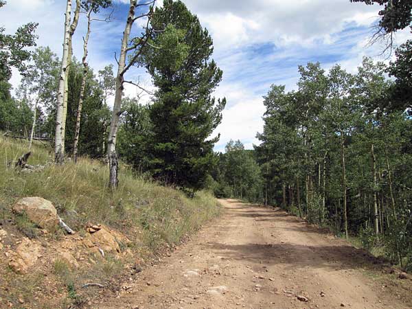 |
Middle section
Photo by:
Adam M
|
I have only drive this lower section as far as the Deer Peak, FR401, intersection
|
|
Data updated - April 21, 2016
4WD Road driven - September 7, 2015
Copyright 4X4Explore.com - 2000-2016 |