| Difficulty: | Number: | Miles: | Altitude: | Obstacles: | Time: |
|---|---|---|---|---|---|
| Easy 1 | FR235 | 1.50 | 7876 to 8040 ft. | NA | 1 hour |
Canyon Lakes Ranger District
Fort Collins, CO 80526
Closure:
July - Best time.
August - Best time.
September - Best time.
October - Watch for early snows.
Accessed:
(Note: Mapping software like Google Maps will show the Lost Lake road starting at 0.6 miles down the Creekmore Lakes Road. This route will take you into private property. Please drive the extra 0.5 miles and respect private property.)
From Livermore, CO. head west on US-287 N for 2.9 miles. Turn left onto Cherokee Park Rd and go 7.6 miles. Turn left onto Co Rd 82E and go 7.7 miles. Slight left onto Prairie Divide Rd and go 1.1 miles. Turn right onto Creedmore Lakes Rd and go 1.1 miles. Turn left on the Forest Service Lost Lake road.
(Note: Mapping software like Google Maps will show the Lost Lake road starting at 0.6 miles down the Creekmore Lakes Road. This route will take you into private property. Please drive the extra 0.5 miles and respect private property.)
 |
Road to Lost Lake photo by: Adam M |
|---|
After passing a small pond on your right that has a few dispersed camp sites around it, you will come to the intersection with FR235A to the right, which is a short spur road to a turn around. From this intersection the main road gets a bit narrower and follows along a small creek through the forest.
 |
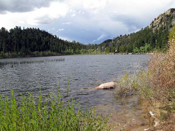
Lost Lake photo by: Adam M |
|---|
At the end of the road you will come to a turn around with a few dispersed camp sites at the north end of Lost Lake. From here there is a hiking trail around the lake.
 |
Lost Lake photo by: Adam M |
|---|