| Difficulty: | Number: | Miles: | Altitude: | Obstacles: | Time: |
|---|---|---|---|---|---|
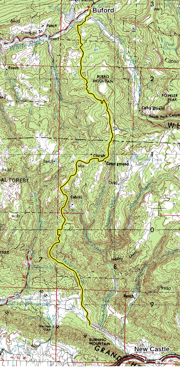
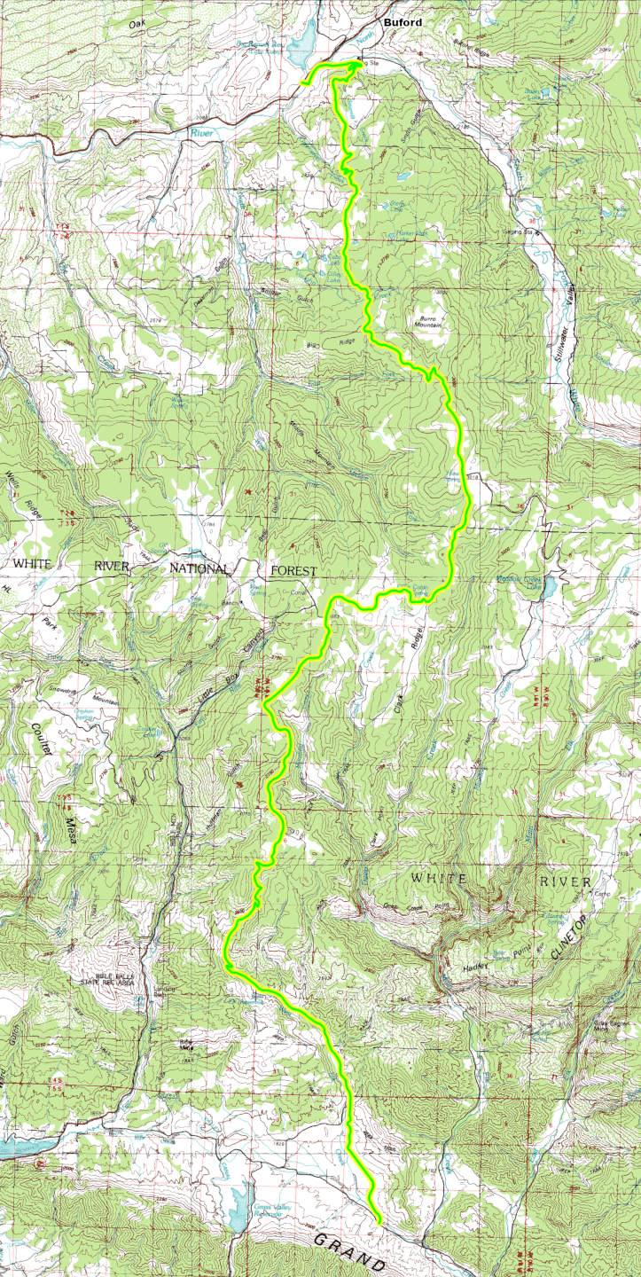
| Graded | FR 245 | 29.32 | 7,000 to 10,000 ft. | NA | 2-3 hours |
White River National Forest, Rifle District
0094 County Road 244, Rifle, CO 81650
(970)625-2371
Closure:
July - Best
August - Best
September - Best
October - Early snows possible
Accessed:
FT2290 Fayville OHV - Motorized - ATV, Motorcycle, Pack and Saddle, Mountain Bike, Hike.
FT2256 Cherry Creek - Non-Motorized - Hiking, Pack and Saddle.
FT2155 Ute Meadow - Non-Motorized - Hiking, Pack and Saddle.
FT1835 North Elk - Non-Motorized - Hiking, Pack and Saddle.
From Buford, CO on County Road 8 head toward New Castle Buford Road for 2.3 miles. Turn left onto County Road 10 and go 1.5 miles. Turn right onto New Castle Buford Road and go 2.8 miles. Continue to follow the New Castle Buford Road as it heads north into the White River National Forest.
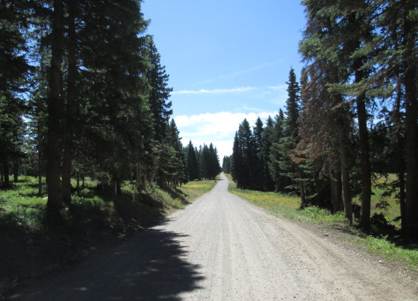
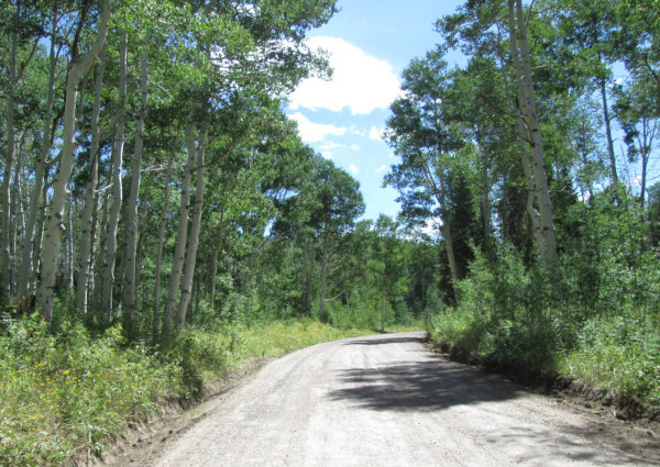 |
North end of the road photo by: Adam M |
|---|
After passing a small parking area on the right side of the road you will climb through three switchbacks. You will pass a spur road on the left, FR245.2, which goes 0.32 miles before ending. A bit further you will come into an open area and pass another spur road, FR240, on the left and then spur road FR241 on the right. Both of these roads only go a short distance to Side By Side trails. The road will then head into the forest again. You will cross another section of private property before passing a private home and then entering the forest again. The road will now travel through the aspen forest for a while before coming to spur road FR245.5R on the left which goes 0.35 miles.
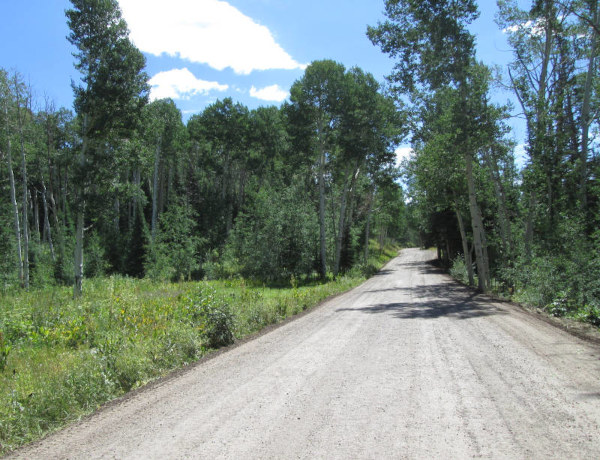 |
Heading toward Burro Mountain photo by: Adam M |
|---|
As the road continues through more aspens heading south it will pass FR243 on the right. Burro Mountain will be to the east here. The road will continue through the forest passing a few small openings before coming to a small parking area on the right which is the connection to FT1835. Past the hiking trail the road crosses a few openings before coming to FR245.5N on the right. There is a dispersed campsite at this intersection. FR245.5N goes about 0.30 miles. Continuing on the main road you will head into pine forests and make two switchbacks as you climb up the south flank of Burro Mountain. The road will come out into the open again and pass another dispersed campsite on the right.
 |
North of Burro Mountain photo by: Adam M |
|---|
Just beyond the campsite you will pass spur road FR245.5G on the right that goes about 1 mile. There is another dispersed campsite here as well. Just up the road you will pass another spur road on the left, FR245.5F, which goes 0.20 miles to an overlook of South Fork Canyon and a dispersed campsite. Continue south on the main road through a few more open areas and you will come to FR245.5C on the right. This spur road goes about three quarters of a mile. Just past this intersection you will come to a major intersection. The road on the left is the Blair Mountain, FR601, road. This is as far as I have driven the New Castle to Buford road.
The following description is based on using Google Earth.
The road will continue through some open areas running along the top of the ridge between Deep Creek and North Elk Creek. The next intersection is with FR248.2 on the right. Just beyond this intersection you will pass where FT2290 crosses the road. There is a dispersed campsite here on the left. The road will run down a small valley and then come into an open area where you will pass FR822 on the left. The road will run along the edge of a large open meadow crossing rolling hills with rocky sides passing FR248 on the right. Just past a small forested area you will pass another dispersed campsite on the left then cross a large open area before going through another small forested section with a dispersed campsite on the left as you come out into the open again. Just a short distance further you will come to an intersection with FR245.4R which is a short road that goes to two dispersed campsites and connects to FT2290. Continue on the main road and you will cross another open area and then head into the forest again passing a dispersed campsite on the right. Further on you will come out of the forest into another open meadow and a large intersection. The road on the right is FR211. Stay to the left to continue on FR245. You will pass a little road on the left that goes to a dispersed campsite. After crossing an open area you will head back into the forest and pass FR830 on the left, a small spur road to two dispersed campsites overlooking the valley of Mansfield Creek. Continuing on you will pass another dispersed campsite on the right before coming to FR245.4D on the left that crosses another large open meadow going to two dispersed campsites, one overlooking Mansfield Creek. Continue on the main road and you will make a 90 degree turn to the left and then pass FR860 on the right. As you continue through the forest you will pass another dispersed campsite on the right. The road will then come to another large meadow with a private ranch in the middle. What looks like the driveway to the property is FR245.4C that crosses the meadow and heads southwest into the forest. The private property is west of FR245.4C. Continue on the main road and you will run along the edge of Mansfield Creek's valley. Shortly you will pass FR245.4A on the right and then pass where FT2290 crosses the road. The road will continue through a forested area and come to another spot where FT2290 crosses the road and a dispersed campsite is on the left side of the road. Following the main road you will continue along the ridge between Mansfield Creek to the east and Huffman Gulch to the west. The next intersection will be with FR245.4J on the right, which is a short loop road that connects with FT2290 and then comes back to FR245 a bit further south. At the second connection with FR245.4J there is a dispersed campsite on the left. Continuing on FR245 you will cross a large open area and pass FR820 on the left. Just past FR820 you will come to the large West Elk Trailhead parking area. This is the start for FT2290 and connects with FR462 on the right and FR819 on the left. You will continue through the forest for a short distance before a few switchbacks will drop you down to West Elk Creek and onto private lands where you will pass a few private homes. The road will once again enter public lands just before Park Reservoir, but will be on a private inholdings where you will pass 4 homes before getting to public lands again for about a mile. The road will pass FT2256 on the left and then three dispersed campsites before leaving public lands. Stay on the road as it passes private ranches in a small valley before coming to County Road 266 which goes to New Castle to the left or Rifle Gap State Park to the right.