| Difficulty: | Number: | Miles: | Altitude: | Obstacles: | Time: |
|---|---|---|---|---|---|
| Easy 1 | FR 250 | 24.00 | 7,060 to 9,560 ft. | NA | 2-3 hours |
Blanco Ranger District
Meeker, Colorado 81641
Closure:
July - Best
August - Best
September - Best
October - Early snows possible
Accessed:
FT2271 - Motorized, 50 inches or less.
FT2272 - Motorized, 50 inches or less.
FT2273 - Motorized, 50 inches or less.
FT2274 - Motorized, 50 inches or less.
FT2275 - Motorized, 50 inches or less.
FT2276 - Motorized, 50 inches or less.
FT2277 - Motorized, 50 inches or less.
FT2278 - Motorized, 50 inches or less.
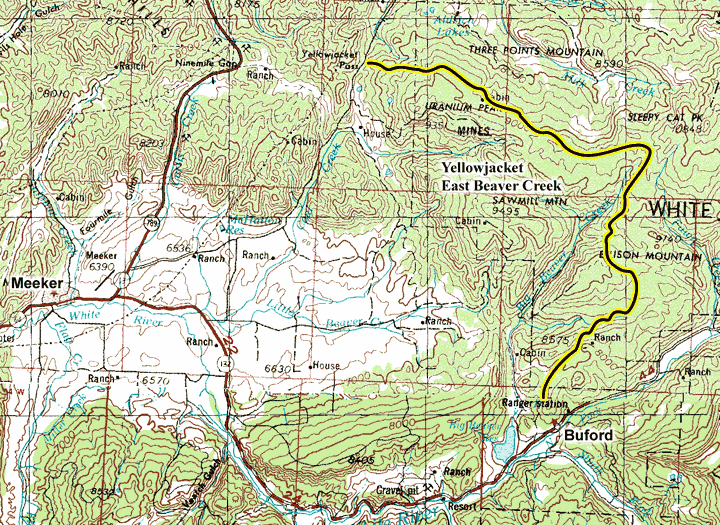
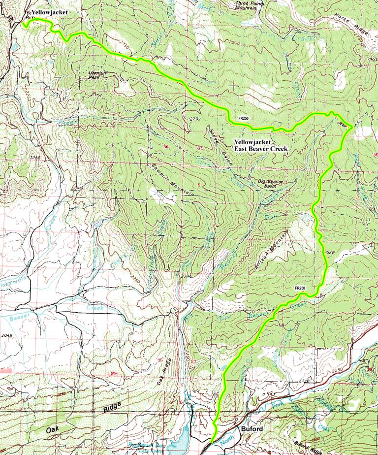
To start at the east end, from Meeker, CO. head east on Market Street towards 6th Street and go 1.7 miles. Turn right onto County Rd 8/State Hwy 132 and continue to follow County Rd 8 for 19.1 miles. Slight left onto County Rd 115 and go 0.5 miles. Turn right to stay on County Rd 115 and then go 1.8 miles to the public lands boundary. This is the start of the Yellowjacket/East Beaver Creek road, FR250.
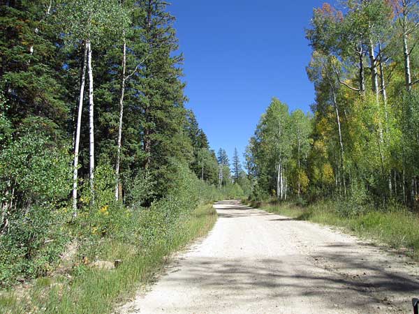 |
West end of the road photo by: Adam M |
|---|
Past the large intersection the road will curve to the left with a spur loop off to the right going to some campsites. The main road will pass a marshy are and then come to the intersection with Martin Ridge, FR253, on your left. Continuing on the main road it will head through heavier forests with no real opening or views. After about a mile and a half from the last intersection will be Latern Ridge, FR254, to your left. FR250 will continue southeast and enter into more aspen forest areas with some openings and small meadows along the road. At a swooping S curve in the road where it runs along the edge of an open meadow will be an intersection with Elbow Park, FR258, on the right. Past this intersection the road heads into the aspen forest heading northeast before it come out into open meadows again.
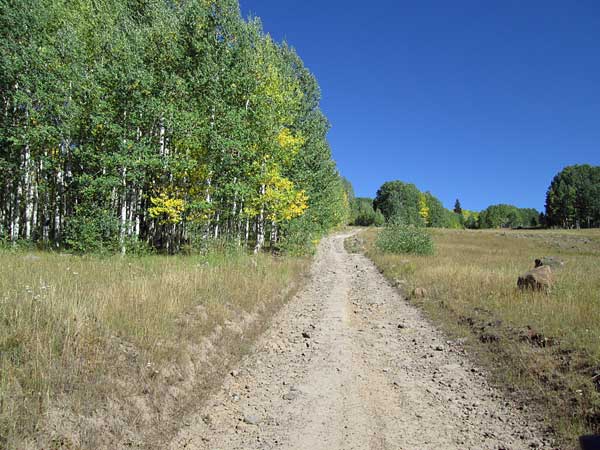 |
East end of the road photo by: Adam M |
|---|
The road will climb a short small hill that is fairly rocky and then top out onto a flat area before it intersects with Moeller Creek, FR290, to the left. From here FR250 is to the right and heads south toward the east side of Big Beaver Basin. About a mile and a half from the intersection with FR290 will be the intersection with Marci Camp, FR270, to the left. It goes about a quarter of a mile to FT2270. The main road will continue south through aspen groves and small meadows. The next intersection, Goff Creek, FR272, will be on the right. It is only a quarte of a mile long before it becomes FT2272. After about a mile and a quarter will be the intersection with Ellison Mountain, FR273, on your right. The road surface is more graded now and within a half mile you will come to a meadow and the intersection with Fawn Creek, FR280, on your left. A quarter mile further will be the intersection with FR288 on your left that goes to private property. The road will now follow East Beaver Creek for a while before crossing it and climbing a low ridge. On the other side of the ridge will be an intersection with Cattle Creek, FR235, on your left. Cattle Creek will connect with County Road 8. In about two miles you will come to Big Lick Reservoir on your right. Just after the reservoir you will come to the Forest boundary. From here you can follow County Road 115 to County Road 8