| Bench
|
|||||||||||||||
|---|---|---|---|---|---|---|---|---|---|---|---|---|---|---|---|
| Maps/GPS: |
|
||||||||||||||
| USGS 7.5' Map: | Blair Mountain | ||||||||||||||
| Statistics: |
|
||||||||||||||
| County: | Garfield | ||||||||||||||
| Adopted by: | |||||||||||||||
| Managed by: | White River National Forest, Rifle District | 0094 County Road 244, Rifle, CO 81650 | (970)625-2371 | ||||||||||||
| Summary: | The Bench 4WD road is a connector between Blair Mountain, FR601, and Cow Lake, FR601.2F, that ends at the Blair Lake Trailhead. | ||||||||||||||
| Attractions: | Scenery, Trail Heads | ||||||||||||||
| Seasonal Closure: |
Agency - November 23 to May 22 |
||||||||||||||
| Best Time: |
June - Possible snow drifts July - Best August - Best September - Best October - Early snows possible |
||||||||||||||
| Trail Heads Accessed: |
Blair Lake FT2048 - Hike, Pack and Saddle. |
||||||||||||||
| Camping: | There is one dispersed campsite at the west end near the intersection with Blair Mountain, FR601, 4WD road. | ||||||||||||||
| Base Camp: | This would be a good area to base camp and explore all of the 4WD road networks in this area of the White River National Forest. | ||||||||||||||
| Fall Colors: | Poor - There are no aspens in this area. | ||||||||||||||
| Navigation: | From New Castle, CO head toward Wheeler Lane and go 0.3 miles. North 7th Street turns slightly left and becomes Midland Ave go 0.4 miles. Continue onto County Road 245/Buford Road. Continue to follow County Road 245 for 4.2 miles. Turn right onto New Castle Buford Road and go 21.4 miles. Turn right onto FR 601 and go 3.3 miles. Turn left onto FR 601 and go 4.1 miles. Turn left onto Forest Road 647. 
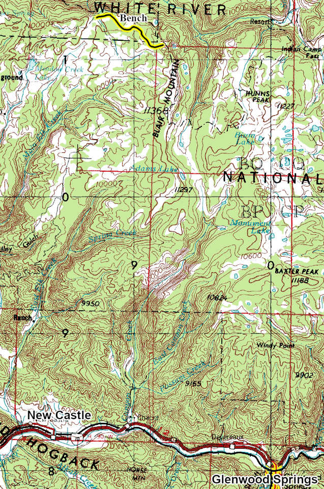
From Buford, CO on County Road 8 head toward New Castle Buford Road for 2.3 miles. Turn left onto County Road 10 and go 1.5 miles. Turn right onto New Castle Buford Road and go 14.3 miles. Turn left onto FR 601 and go 3.3 miles. Turn left onto FR 601 and go 4.1 miles. Turn left onto Forest Road 647. |
||||||||||||||
| History: | |||||||||||||||
| Description: | |||||||||||||||
| The Bench 4WD road is a connector from Blair Mountain, FR601, 4WD road to Cow Lake, FR601.2F, 4WD road and the Blair Lake Trailhead. I have only driven the short section from Cow Lake to the Blair Lake Trailhead. The majority of the description is from viewing Google Earth. 
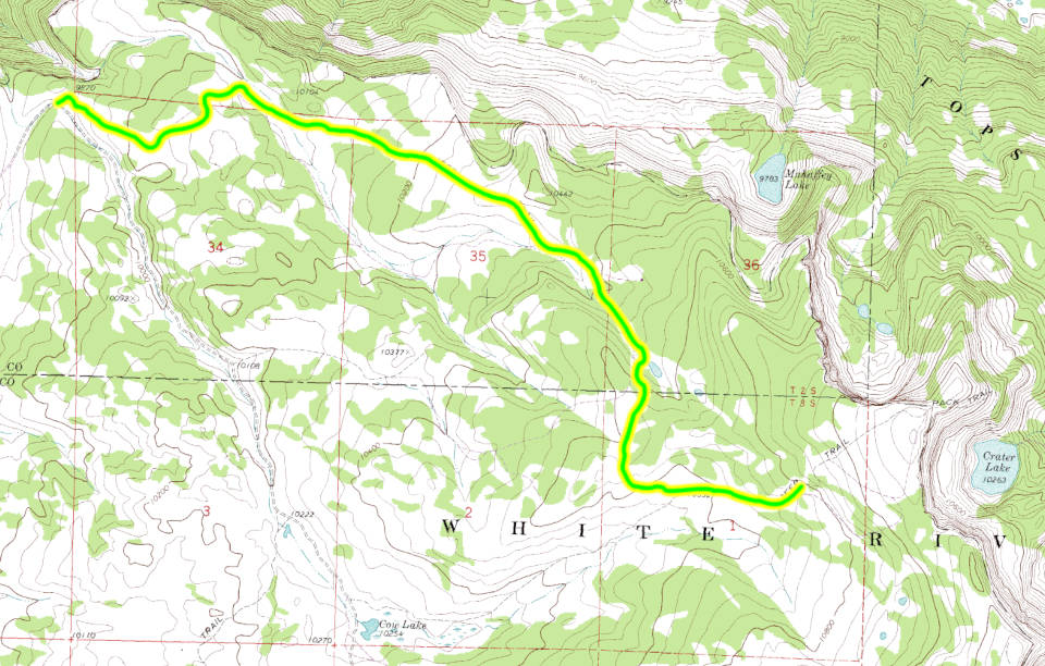
Starting from the Blair Mountain 4WD road you will head east passing a spur road on the left that goes to a dispersed campsite. The road will turn and head south east and then northeast passing through open areas with pine forest surrounding them. The road will turn southeast again and head down a shallow valley surrounded by pine forests. The road is a single lane two track with good sight views of oncoming traffic. The Bench 4WD road will continue to follow the small valley which will broaden as it continues southeast. The road will finally come to a small natural pond where it will turn west and climb a low hill over into another shallow valley and then out into a large open area where it will turn east again and come to a connection with with the Cow Lake, FR601.2F, 4WD road. Taking the left will continue with the Bench 4WD road. After about a half mile you will come to a small parking area which is the Blair Lake tralhead. Blair Lake Trail is a hiking trail that climbs up a sloping ridge to a point overlooking the canyon of the South Fork of the White River with Crater Lake below. There is a switchback hiking trail down to Crater Lake from the point. The hiking trail will continue south along the imposing east face of Blair Mountain passing Blair, Shadow, and Jet Lakes. |
|||||||||||||||
| Data updated - May 3, 2026 4WD Road driven - July 28, 2025 Copyright 4X4Explore.com - 2000-2026 | |||||||||||||||