

| Difficulty: | Number: | Miles: | Altitude: | Obstacles: | Time: |
|---|---|---|---|---|---|
| Easy 2 | CR 10 | 3.68 | 10,450 to 12,690 ft. | NA | 1-2 hours |
Closure:
July - Best
August - Best
September - Best
October - Snow may close the road
Accessed:
Gladstone was quiet for many years until Olaf Nelson, who worked for the Sampson Mine, staked a claim on a vein of ore that was outside the Sampson claim. In 1887 he quit the Sampson and sank a 50 foot shaft on his new claim, then ran a 50 foot drift to intercept the vein. He began shipping ore from the Gold King mine. Nelson died in 1890. In 1894, Cyrus Davis and Henry Soule, owners of the Harrison Mine, were looking for promising mine properties to purchase. At the suggestion of Willis Z. Kinney, manager of the Harrison, they purchased the Gold King from Nelson's widow for $15,000.00. By 1895 the Gold King included 40 other claims including the Sampson. In 1896, at 400 feet in depth, a large ore body was discovered.
At this point a mill was built in Gladstone to process the gold, silver, and copper. Originally a 20 stamp mill it was enlarged to be an 80 stamp mill with the building being 460 feet long. A boarding house and company housing were built by the mill while Gladstone expanded with a hotel, general store, meat market, and a boarding house as well. With its 40 employees the mill was processing 400 tons of ore a day with a 50 to 60 ton yield of concentrate high in gold, silver and copper.
The Denver and Rio Grande railroad had been in Silverton since 1882. What was needed was a connecting railroad from Silverton to Gladstone. In 1898 Kinney, supervisor for the Gold King, approached Alexander Anderson about building a branch line up Cement Creek. Otto Mears was approached, but he was back east and president of both The Mack Truck Company and The Chesapeake Short Line Railroad. He was not interested. In 1899, the owners of the Gold King mine decided to build the railroad themselves. They needed a connection with Silverton to help lower shipping expenses. They chartered the Silverton Gladstone and Northerly Railroad on April 6, 1899. The Rocky Mountain Construction Company was hired to build the line up Cement Creek to the Mogul Mill and Gold King Mill at Gladstone. At first the Silverton Gladstone and Northerly railroad leased locomotives from the Denver & Rio Grande, but later they purchased their own locomotives as well as a passenger / baggage car and twenty frieght cars. The railroad reduced shipping cost of the mills concentrate making the Gold King very prosperous. In 1907 a fire destroyed much of the Gold King Mine, closing it. It re-opened in 1910, but had to close again due to litigation.
 |
Mogul Mine Silverton Miner, 1907 |
|---|
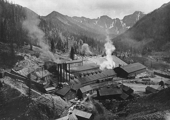
 |
Mogul Mill in 1907 Morris W Abbott |
|---|
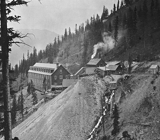 |
Gold King Mine in 1906 San Juan Historical Society |
|---|
 |
Gold King Mill in 1901 Richard A Ronzio |
|---|
In 1915 Otto Mears purchased the Silverton Gladstone and Northerly Railroad and it became part of the Silverton Northern. The Gold King Mill continued to operate until 1918 when it when the ore seemed to be depleted and a new company purchased the mine and operated it until the fall of 1922. The railroad to Gladstone continued running intermittently until 1924. In 1931 it was dismantled. The Gold King was the Second best producer in the area and shipped 711,144 tons of ore while in operation. This ore was valued at $8,385,407.00.
Standard Metals Corporation purchased the Sunnyside Mine in 1959. It is on the east side of Bonita Peak. They planned to work the Sunnyside Mine from the west, or Gladstone side of the mountain. To do this, they built the American Tunnel to connect the underground workings of the Sunnyside and Gold King mines. In building the American Tunnel the town of Gladstone was buried. The ore was removed through the tunnel portal in Gladstone, and transported by truck down the old Silverton Gladstone and Northerly Railroad grade. The grade was widened to accommodate the huge trucks.
Just below Hurricane Pass was the town of Poughkeepsie. In 1885 it was reported to have a store, restaurants, saloons, and many other buildings. There was a post office and the town had its own newspaper, the Poughkeepsie Telegraph. By 1890 the town was abandonded.
Evans, Mark L The Silverton Railroad, Gladstone Internet.
Jessen, Kenneth Ghost Towns Colorado Style, Volumn 3, 1st ed. Loveland, Colorado: J.V. Publications, 2001. Print.
Gregory, Marvin and Smith, P. David Mountain Mysteries Ouray, Colorado: Wayfinder Press, 1984, 1985, 1987. Print.
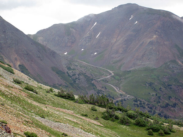 |
View of Hurricane Pass from Corkscrew photo by: Adam M |
|---|
Past this intersection the road will become a narrower ledge road that is rougher.
 |
Ledge road section, looking up photo by: Adam M |
|---|
 |
Ledge road section, looking down photo by: Adam M |
|---|
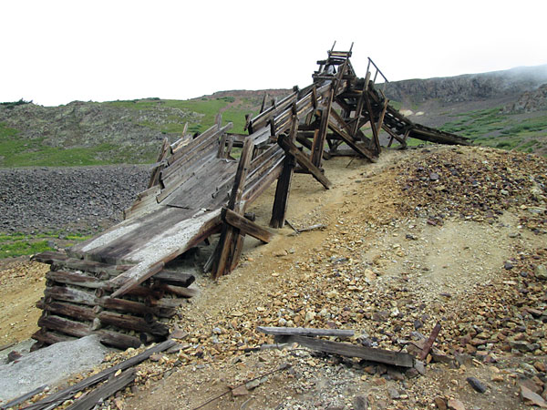
It will climb up above the north side of the Mogul Mine site before it turns to the north and heads up a narrow valley. You will pass an old ore chute along side the road.
 |
Snowdrift Mine ore chute in 2020 photo by: Adam M |
|---|
 |
Snowdrift Mine ore chute in 2015 photo by: Adam M |
|---|
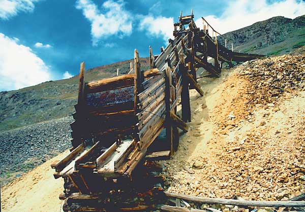 |
Snowdrift Mine ore chute in 1988 photo by: Adam M |
|---|
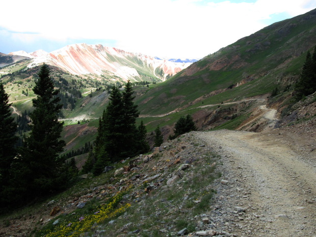
Past this spot the road becomes roughter. You will come to an intersection with a road to the right that goes to a tailing pile near the top of Hurricane Peak. Continuing on the main road you will drive through a rocky basin as you head toward the final climb up to Hurricane Pass.
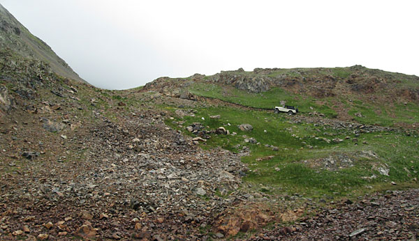 |
Climb before the pass photo by: Adam M |
|---|
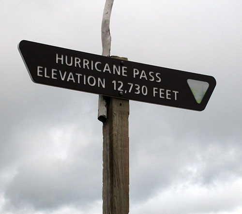 |
Hurricane Pass sign photo by: Adam M |
|---|
From the top you can see Lake Como below. The road will start down right away and run along a cliff before connecting with the California Gulch road, Cnty 19.