Meadow Creek Cow Camp
 |
| Maps/GPS: |


|
| USGS 7.5' Map: |
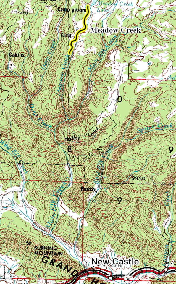
Meadow Creek Lake |
| Statistics: |
| Difficulty: |
Number: |
Miles: |
Altitude: |
Obstacles: |
Time: |
| Easy 2 |
FR821 |
6.05 |
9,575 ft. |
NA |
1 hour |
|
| County: |
Garfield |
| Adopted by: |
|
|
|
| Managed by: |
White River National Forest, Rifle District |
0094 County Road 244, Rifle, CO 81650 |
(970)625-2371 |
| Summary: |
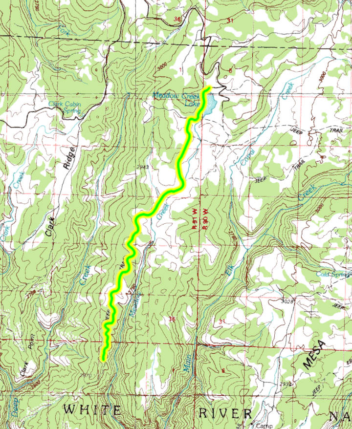
The Meadow Creek Cow Camp 4WD road heads south from Meadow Lake following Meadow Creek. |
|
| Attractions: |
Trailhead |
Seasonal
Closure: |
Agency - November 23 to May 22
|
| Best Time: |
June - Possible snow drifts
July - Best
August - Best
September - Best
October - Early snows possible |
Trail Heads
Accessed: |
Meadow Lake Picnic Area, east shore - $9 fee, picnic, fishing
Deep Creek Ridge East FT2294 - Side by Side, ATV, Motorcycle, Mountain Bike, Pack and Saddle, Hike.
FT821.1I - Mountain Bike, Pack and Saddle, Hike.
FT821.1L - Mountain Bike, Pack and Saddle, Hike.
Deep Creek Ridge FT2293 - Mountain Bike, Pack and Saddle, Hike.
Last Chance FT2158 - Mountain Bike, Pack and Saddle, Hike.
|
| Camping: |
There are two small campgrounds near the lake. Meadow Lake Campground has 10 sites for tents or small trailers, Meadow Ridge Campground has 20 sites for tents and small trailers. Both campgrounds have a $25 fee, have a pit toilet and are open 6/4 to 10/2. There is one dispersed campsite near the end of FR821.1B. |
| Base Camp: |
This would be a good area to base camp and explore all of the 4WD road networks in this area of the White River National Forest. |
| Fall Colors: |
Very Good - There are aspens south and east of Meadow Lake.
|
| Navigation: |
From New Castle, CO head toward Wheeler Lane and go 0.3 miles. North 7th Street turns slightly left and becomes Midland Ave go 0.4 miles. Continue onto County Road 245/Buford Road. Continue to follow County Road 245 for 4.2 miles. Turn right onto New Castle Buford Road and go 21.4 miles. Turn right onto FR 601 and go 3.5 miles. Turn right onto Forest Road 823 and go 2.2 miles to the Meadow Creek Campground. At the campground entrance turn left onto FR821.
From Buford, CO on County Road 8 head toward New Castle Buford Road for 2.3 miles. Turn left onto County Road 10 and go 1.5 miles. Turn right onto New Castle Buford Road and go 14.3 miles. Turn left onto FR 601 and go 3.5 miles. Turn right onto Forest Road 823 and go 2.2 miles to the Meadow Creek Campground. At the campground entrance turn left onto FR821.
|
| History: |
Meadow Creek Reservoir, often locally called Meadow Lake, was completed in 1958. It is a natural lake that was enhanced with an earthfill dam for recreational use and water storage. The dam is 61 feet tall with the lake holding 1,389 acre-feet of water.
Meadow Creek Cow Camp is a traditional cow camp used seasonally by ranchers for cattle grazing management, rider and crew shelter, and horse and equipment staging. The Ute people were forced out of this area in 1882, opening the area to homesteading and livestock operations. Ranchers rapidly expanded into the high country for summer cattle grazing, establishing cow camps like Meadow Creek. Garfield County was created in 1883, formalizing land records and grazing allotments. Many early ranching families established seasonal camps in the Flat Tops during this period. By the early 1900s, the Forest Service began regulating grazing allotments. Cow camps such as Meadow Creek were standardized as base camps for range riders, locations for corrals, tack sheds, and tent platforms. These became waypoints for moving cattle between meadows and timbered slopes with the change in seasons.
|
| Description: |
The Meadow Creek Cow Camp 4WD road starts out as a graded and maintained road that leaves the Meadow Lake, FR823, 4WD road at the Meadow Lake Campground. The road will run along the west shore of the lake passing the Meadow Lake Picnic Area on the west shore. There is a pit toilet, picnic tables, and a boat ramp at the picnic area. The Meadow Creek Cow Camp 4WD road will continue south passing the earthfilled dam of the lake and curve to the west coming to an intersection with FR821.1B going to the right. This is a short spur road that ends at FT2294 and a dispersed campsite. Continue left here and the road will will become a two track crossing a small drainage and then climbing up a hill passing the connection with FT821.1L. As the road levels out you will pass West Ute Creek, FR648, 4WD road on the left.
I have not driven the rest of Meadow Creek Cow Camp. The following description is based on Google Earth.
The Meadow Creek Cow Camp 4WD road will head south following Meadow Creek as it passes a small aspen grove to the west. The road will head to the left dropping down to follow along the small Meadow Creek drainage passing another connection with FT821.1L on the right. Past this connection you will come to a large set of corrals and two sheds, the present day cow camp. From here the road turns west up a small drainge passing a connection with FT2293 on the right as it climbs up above the creek again to run along the low hills. The road will continue south zig zaging along the hills following the creek which is out of sight as it has dropped down into a deeper gorge that has formed in the valley floor. Finally the road will end and FT2158 continues following the creek.
|
|
Data updated - April 5, 2026
4WD Road driven - July 28, 2025
Copyright 4X4Explore.com - 2000-2026 |