

| Difficulty: | Number: | Miles: | Altitude: | Obstacles: | Time: |
|---|---|---|---|---|---|
| Easy 1 | FR585, Cnty 7 | 7.69 | 9,460 to 11,800 ft. | NA | 1-2 hours |
Bayfield, CO 81122
Closure:
July - Best
August - Best
September - Best
October - May be snowed closed
Accessed:
Ice Lake Trail #505 - Hiking, Horseback riding.
In 1882 gold was discovered along South Mineral Creek. The Bandora Mine was established on the northern slope of Fuller Peak and a small community developed. In 1890, William Sullivan began developing the Bandora Mine, which proved rich silver ore. He sold it in 1891 to investors that organized the Bandora Mining & Milling Company. No activity took place at the mine and then the Silver Crash of 1893 happened continuing the inactivity. The ownder finally had enough of waiting and reopened the mine under superintendent James B. Snow in 1896. Because of the mines isolation the owners built a mill to separate out waste from the ore. Also, a contract was worked out with Ben Harwood to improve the existing trail into a road. In 1897, the owners leased the Bandora to Patterson & Johnson.
The next year, 1898, the partnership did not renew the lease. The Bandora company conducted some development to restore the mine to a ready state, but the property went idle. The Ross Mining & Milling Company leased the mine in 1907 because its ore was suitable material for the Kendrick-Gelder Smelter, which the firm had purchased in 1905. In 1908 the company sold the smelter and relinquished the lease on the Bandora. At this time, William Sullivan bought the mine back to develop another section of the vein, and began production. He was rewarded in 1911 with a rich strike, which sustained limited production until around 1912, when he suspended operations because the best payrock was gone. When metals values began to creep upward, Sullivan waited until 1916 and reopened the Bandora. He employed a small crew until 1920, when metals prices reached their peak. Sullivan exploited the positive market to sell to Henry Wycoff, before metals prices fell within a year. Wycoff prepared for production and even contemplated moving the Yukon Mill onto the property, before the 1921 depression struck and stopped operations at the mine again. The Sullivan family leased the remote property to Wilbur Maxwell & Associates in 1936. Maxwell rehabilitated the mine, produced payrock, and then turned the property over to the Blanco Mining Company in 1938. Blanco realized minor profits until 1940.
Smith, P. David The Road that Silver Built, 1st ed. Lake City, Colorado: Western Reflections Publishing Company, 2009. Print.
Twitty, Eric Basins of Silver, 1st ed. Lake City, Colorado: Western Reflections Publishing Company, 2009. Print.
Twitty, Eric Historic Mining Resouces of the San Juan County, Colorado United States Department of the Interior: OMB No.1024-0018, Print.
Jessen, Kenneth Ghost Towns Colorado Style, Volumn 3, 1st ed. Loveland, Colorado: J.V. Publications, 2001. Print.
 |
Beginning section photo by: Adam M |
|---|
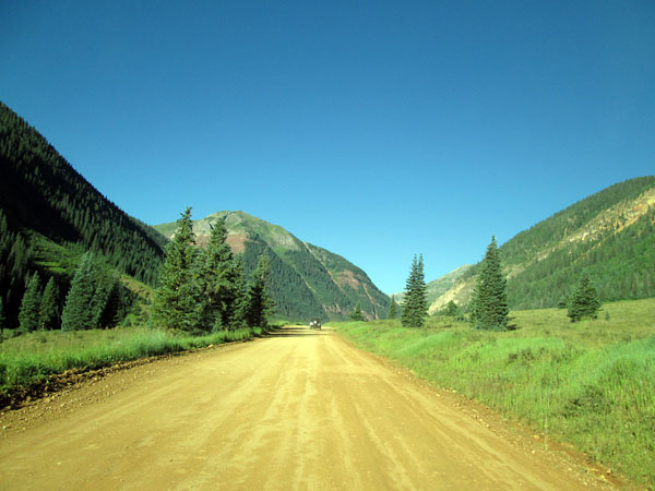
Past the South Mineral Campground, the last of the four, the road becomes less maintained and more of a two track. You will pass a Waterfall just past the South Mineral Campground that is a very short hike from the road.
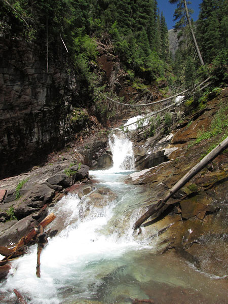 |
Waterfall near road side photo by: Adam M |
|---|
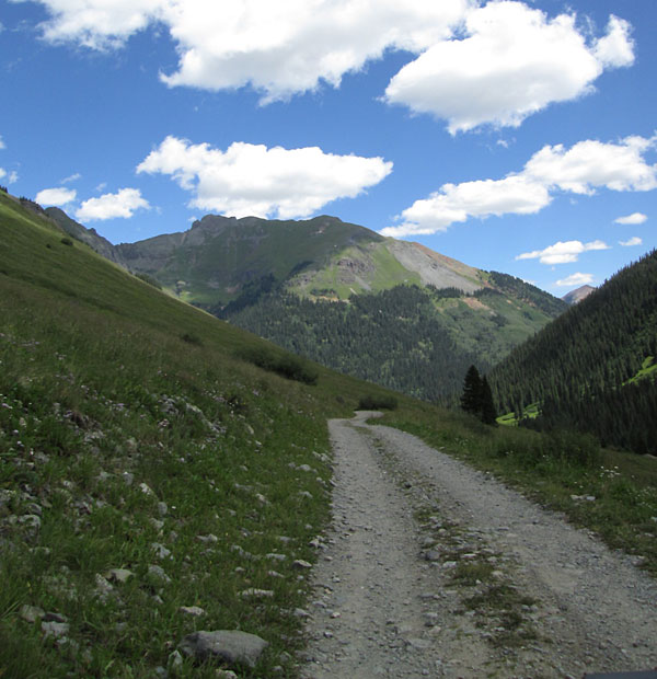
The road will climb up above the creek and follows the valley created by Fuller Peak and Beattie Peak to the north and the Twin Sisters Peak to the south.
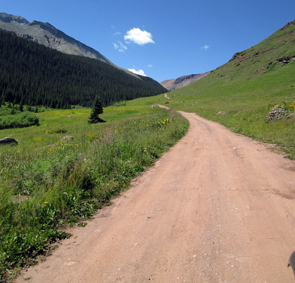 |
Middle section photo by: Adam M |
|---|
The road will pass the Bandora Mine site which still has a few structures standing. There is a foundation that was most likely for a small mill. Below the tailings near the creek is a small cabin.
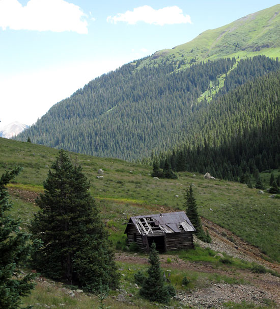 |
Cabin below Bandora Mine photo by: Adam M |
|---|
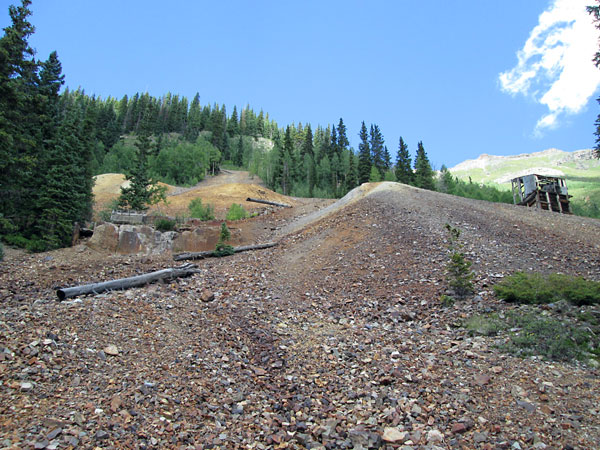 |
Bandora Mine photo by: Adam M |
|---|
After passing the Bandora Mine the road heads down to the bottom of the valley and crosses to the other side. You will cross the South Fork of Mineral Creek and come to a turn around area where the Rico-Silverton trail begins. There is parking here as well as dispersed camp sites. One short spur road to the west climbs up to a small camp site in the trees.
 |
Heading toward Rico-Silverton trail head photo by: Adam M |
|---|
Just past the Bandora Mine you will pass an intersection to the right. This is a continuation of the road that goes to the Big Three Mine where the road ends. From here there is a trail over a pass to Lake Hope. This trail will continue down to Trout Lake below Lizard Head Pass. On the way back out you will have a great view of the mountains to the east of Clear Lake.
 |
Heading back toward the campgrounds photo by: Adam M |
|---|