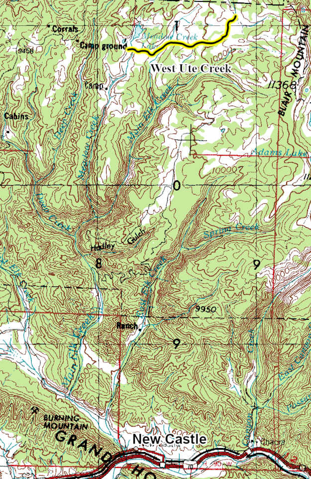
West Ute Creek
 |
| Maps/GPS: |


|
| USGS 7.5' Map: |
Meadow Creek Lake |
| Statistics: |
| Difficulty: |
Number: |
Miles: |
Altitude: |
Obstacles: |
Time: |
| Easy 4 |
FR648 |
5.22 |
10,222 ft. |
Water-1 |
1 hour |
|
| County: |
Garfield |
| Adopted by: |
|
|
|
| Managed by: |
White River National Forest, Rifle District |
0094 County Road 244, Rifle, CO 81650 |
(970)625-2371 |
| Summary: |
The West Ute Creek 4WD road crosses the rolling plateau west of Blair Mountain. |
|
| Attractions: |
Trailhead |
Seasonal
Closure: |
Agency - November 23 to May 22
|
| Best Time: |
June - Possible snow drifts
July - Best
August - Best
September - Best
October - Early snows possible |
Trail Heads
Accessed: |
Ute-Elk FT2028 - Pack and Saddle, Hike.
|
| Camping: |
There are no dispersed campsites along the West Ute Creek 4WD road. |
| Base Camp: |
This would be a good area to base camp and explore all of the 4WD road networks in this area of the White River National Forest. |
| Fall Colors: |
Very Good - There are aspens at the west end of the road along the edges of the Corral Creek valley.
|
| Navigation: |
From New Castle, CO head toward Wheeler Lane and go 0.3 miles. North 7th Street turns slightly left and becomes Midland Ave go 0.4 miles. Continue onto County Road 245/Buford Road. Continue to follow County Road 245 for 4.2 miles. Turn right onto New Castle Buford Road and go 21.4 miles. Turn right onto FR 601 and go 3.5 miles. Turn right onto Forest Road 823 and go 2.2 miles. Turn left onto Forest Road 821 and go 0.9 miles. Turn left onto Forest Road 823 and go 0.4 miles. Turn left onto Forest Road 648.
From Buford, CO on County Road 8 head toward New Castle Buford Road for 2.3 miles. Turn left onto County Road 10 and go 1.5 miles. Turn right onto New Castle Buford Road and go 14.3 miles. Turn left onto FR 601 and go 3.5 miles. Turn right onto Forest Road 823 and go 2.2 miles. Turn left onto Forest Road 821 and go 0.9 miles. Turn left onto Forest Road 823 and go 0.4 miles. Turn left onto Forest Road 648.
|
| History: |
The landscape along the West Ute 4WD road is exposed beds of the Parachute Creek Member of the Green River Formation from the Eocene, ~50 million years go. These rocks formed in Lake Uinta, a long-lived Eocene lake that covered much of northwest Colorado, northeast Utah, and southwest Wyoming. Along the 4WD road are periglacial deposits, frost-shattered rubble and patterned ground. The large boulders lying across the plateau are from smaller Pleistocene glaciers that once covered parts of the plateau. |
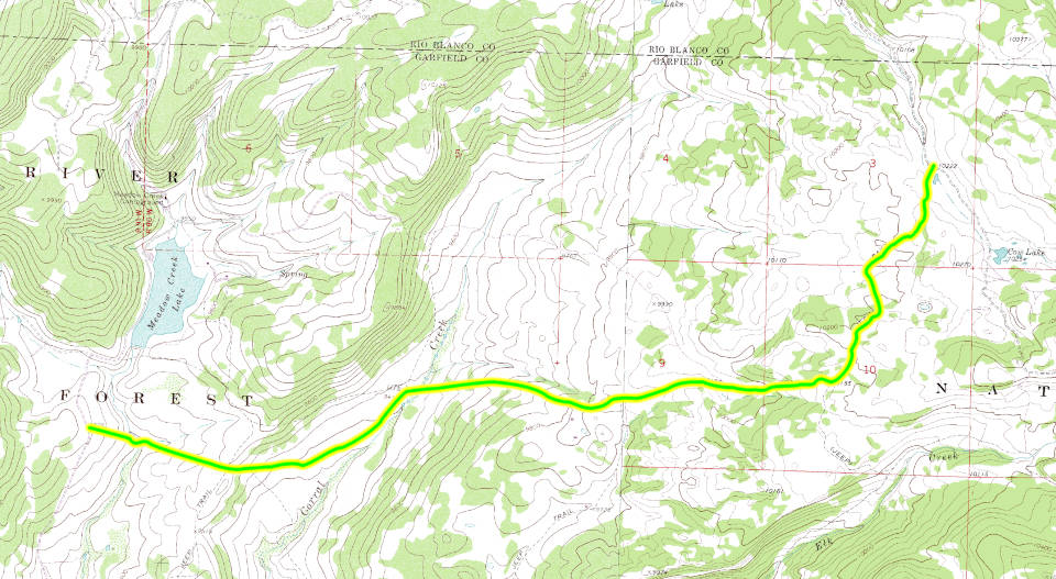
| Description: |
The West Ute Creek 4WD road is a two track heading down to Meadow Creek from the Meadow Creek Cow Camp, FR821, 4WD road. You will drop down a gradual slope to cross Meadow Creek, not wide or deep as you are close to the headwaters of the creek which is now Meadow Lake Reservoir. After crossing the creek the road will climb up to cross a wide valley.
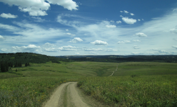 |
Heading across the valley to Corral Creek
photo by:
Adam M |
The road will cross a low ridge into the valley of Corral Creek. This is where there are groves of aspen trees along the rolling hills surrounding the valley. The road will continue northeast toward Corral Creek.
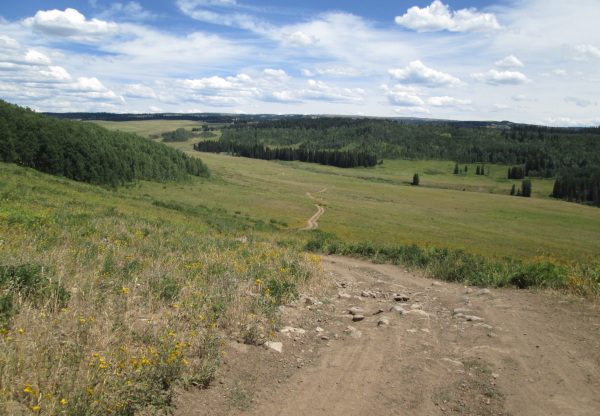 |
Looking down to Corral Creek
photo by:
Adam M |
As you approach the creek you will pass Corral Creek, FR650, on the left which goes further up the Corral Creek valley, crosses the ridge to the west and connects back to Meadow Lake Reservoir. Staying right you will be presented with the Corral Creek crossing. This crossing is longer and deeper than Meadow Creek.
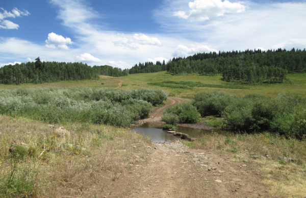 |
Crossing at Corral Creek
photo by:
Adam M |
After crossing the creek you will climb up the valley heading east going through a couple of aspen groves. Once over the ridge the landscape will change with more pine trees and large piles of rocks and shattered slabs. The road will pass through some open meadows after passing through one of the rock areas and then run along the edge of a slab section of landscape.
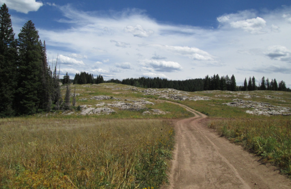 |
Shattered rock patches along the road
photo by:
Adam M |
As you cross the slab area you will pass a faint parking area on the right which is the connection with FT2028. Continue toward the northeast and you will cross a few more slab sections and then run along a section of pine forest. As you pass the pines you will come out into a large open area. The road will make a couple of wide curves following the landscape before connecting with Blair Mountain, FR601, 4WD road.
|
|
Data updated - April 10, 2026
4WD Road driven - July 28, 2025
Copyright 4X4Explore.com - 2000-2026 |